Broadway, Belfast
Introduction
The photograph on this page of Broadway, Belfast by Albert Bridge as part of the Geograph project.
The Geograph project started in 2005 with the aim of publishing, organising and preserving representative images for every square kilometre of Great Britain, Ireland and the Isle of Man.

There are currently over 7.5m images from over 14,400 individuals and you can help contribute to the project by visiting https://www.geograph.org.uk
Broadway, Belfast
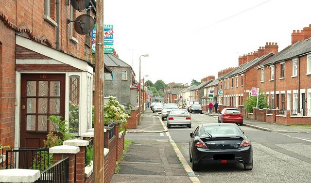
Image: © Albert Bridge Taken: 12 Aug 2009
Broadway was built, over a number of years in the late 19th century, running from the Falls Road via the Donegall Road to Donegall Avenue. The opening of the M1 roundabout, later enlarged for the Westlink and, later still, the Broadway underpass Image and Image severed it. This is the section of the street at Glenmachan Street (off the Donegall Road) looking towards Donegall Avenue. Image shows the same view in June 2011.
Images are licensed for reuse under creativecommons.org/licenses/by-sa/2.0
Image Location
Latitude
54.587785
Longitude
-5.955775