1
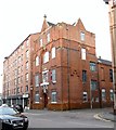
Sandy Row, Belfast
The southern end of Sandy Row (from Bradbury Place to the Donegall Road) seen from King William Park
Image
Image: © Albert Bridge
Taken: 24 May 2009
0.01 miles
2
The Sandy Row Orange Hall dressed for the Queen's Diamond Jubilee
Sandy Row is famous for its Orange parades.
http://www.youtube.com/watch?v=D0dJHVPZzz8
Image: © Eric Jones
Taken: 21 May 2012
0.02 miles
3
Sandy Row Orange Hall
This is the home of No 5 District Lodge.
http://www.belfastorange.net/district-lodges/no-5-district/
Image: © Eric Jones
Taken: 17 Feb 2015
0.02 miles
4
Belfast Youth Hostel, Donegall Road
Image: © Eric Jones
Taken: 20 May 2012
0.02 miles
5
An invite to "Take a dander down the Pride of Belfast"
The Pride of Belfast is, of course, Loyalist Sandy Row. "Dander" is an Ulster-Scots word meaning " A gentle meandering walk with no particular haste or purpose" (https://en.wiktionary.org/wiki/dander ).
www.historicsandyrow.co.uk
Image: © Eric Jones
Taken: 30 Jun 2015
0.02 miles
6
Ulidia House at the Sandy Row/Donegall Road cross roads
This is a six storey block of apartments built for local residents. The spire of the Crescent Church, which marks the southern end of Sandy Row, can be seen in the background.
http://www.g-m-design.com/gallery.php?galleryid=27&galleryname=Donegall%20Road,%20Belfast&cat=project_residential&pname=Residential
Image: © Eric Jones
Taken: 30 Jun 2015
0.02 miles
7
Tollgate House, Belfast (2)
See
Image Tollgate House under construction in 1987.
Image: © Albert Bridge
Taken: 6 Sep 1987
0.03 miles
8
Decorated shutter door, Bradbury Place, Belfast (August 2017)
Decorated shutter door at 31 Bradbury Place. “Te’kila is Mexican taqueria pop up – serving authentic Mexican food and drinks in Belfast.” I have no connection with the business.
Image: © Albert Bridge
Taken: 22 Oct 2017
0.03 miles
9
Nos 33-35 Bradbury Place, Belfast (June 2016)
Currently vacant premises with a “for sale” sign. The agents’ description includes “The property is comprised of a 3 storey mid-terrace commercial property with accommodation extending to c. 1,915 sq.ft (177.90 sq.m) over 3 floors. The property has most recently been used as office accommodation and has been fitted out to a good specification to include a glazed shopfront with electric roller shutters, carpet floors, part perimeter trunking, plastered & painted walls, suspended ceilings with recessed fluorescent lighting and kitchen facilities. The property also benefits from Hot Food Planning Consent for carry-out with sit-in facilities. The property is being sold with the benefit of Vacant Possession and may also be capable of sub-divison [sic] which may suit owner occupiers or investors.” This photograph appears as a matter of record only. I have no connection with any of the parties involved in the sale.
Image: © Albert Bridge
Taken: 19 Jun 2016
0.03 miles
10
Nos 33-35 Bradbury Place, Belfast (January 2017)
Now with a “sold” patch on the agents’ sign.
Image: © Albert Bridge
Taken: 28 Jan 2017
0.03 miles


