1
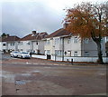
Kenmore Crescent, Filton
Viewed across Braemar Avenue.
Image: © Jaggery
Taken: 6 Nov 2010
0.02 miles
2
Horfield, Monk's Park
Image: © Mike Faherty
Taken: 20 Jul 2011
0.03 miles
3
Braemar Avenue west of Rannoch Road, Filton
The view from near the corner of Rannoch Road, looking past speed bumps towards houses on the south side of Braemar Avenue.
Image: © Jaggery
Taken: 6 Nov 2010
0.08 miles
4
Horfield, Kenmore Crescent
Image: © Mike Faherty
Taken: 20 Jul 2011
0.09 miles
5
Lomond Road, Filton
Houses viewed from the corner of Braemar Avenue.
A red helicopter, just about visible above the third pair of semis, was noisily disturbing an otherwise quiet Saturday morning in late autumn.
Image: © Jaggery
Taken: 6 Nov 2010
0.09 miles
6
Houses on Dunkeld Avenue
This row of thirties semi detached pebble dashed houses is on the bottom end of Dunkeld Avenue at its junction with Southmead Road the B4056. Dunkeld Ave curves to the left after these houses and runs parallel to Southmead Road, the road in the foreground.
Image: © Nigel Mykura
Taken: 23 Feb 2013
0.11 miles
7
Braemar Crescent, Filton
Houses on Braemar Crescent, viewed across Braemar Avenue from the corner of Rannoch Road.
Image: © Jaggery
Taken: 6 Nov 2010
0.11 miles
8
Southmead Road leaves Bristol
Looking to the NE along Southmead Road (B4056) past the point where it crosses the northern limits of Bristol and enters South Gloucestershire and Filton. Street name signs on the camera side include the Bristol BS code (such as BS8 or BS16) whereas street name signs in South Gloucestershire do not.
Image: © Jaggery
Taken: 6 Nov 2010
0.12 miles
9
Old Boundary Marker by Kenmore Grove, Bristol
Parish Boundary Marker by the UC road, in parish of Bristol (City of Bristol District), Kenmore Grove, next to the junction with the B4056, Southmead Road, against garden wall.
Inscription reads:-
C B
----
1904
Surveyed
Milestone Society National ID: GL_BSFIL01pb
Image: © Milestone Society
Taken: Unknown
0.13 miles
10
Filton : Southmead Road B4056
Looking along Southmead Road.
Image: © Lewis Clarke
Taken: 10 Aug 2022
0.13 miles


