1
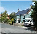
Solar panels, Horsecastle Farm Road, Yatton
Viewed from the corner of Wakedean Gardens. Solar panels cover most of the south-facing roof of a Horsecastle Farm Road house.
Image: © Jaggery
Taken: 23 Jul 2011
0.01 miles
2
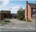
Concrete posts at the western end of Horsecastle Farm Road, Yatton
Opposite the turning into Jones Close http://www.geograph.org.uk/photo/2591472 three concrete posts mark the end of the driveable part of Horsecastle Farm Road. Beyond the posts is a footpath and cycleway leading to the corner of Brunel Way and Arnold's Way.
Image: © Jaggery
Taken: 23 Jul 2011
0.07 miles
3
Woodmill, Yatton
Viewed from Wemberton Lane. Woodmill is a cul-de-sac of 16 houses, numbered 1 to 12 and 14 to 17. The absence of a number 13 is an example of triskaidekaphobia, a fear of (using) the number 13, based on the superstition that the number brings bad luck.
Image: © Jaggery
Taken: 23 Jul 2011
0.09 miles
4
Horsecastle Chapel, Yatton
The modern purpose-built independent evangelical church is on Horsecastle Farm Road.
Image: © Jaggery
Taken: 23 Jul 2011
0.09 miles
5
Jones Close, Horsecastle, Yatton
Viewed from the Horsecastle Farm Road end. In the middle of the cars, a Royal Mail bicycle is leaning on a lamppost. The postman is near the right edge of the view, wearing an orange dayglo vest.
Image: © Jaggery
Taken: 23 Jul 2011
0.10 miles
6
Oxford Instruments, Yatton
This is the northern entrance from the B3133 (here named North End) to the Oxford Instruments site, one of 25 offices and factories in Europe, USA, China and Japan. The company, which has about 1,250 employees worldwide, supplies high-tech instruments and systems.
As the first commercial spinoff company from Oxford University, Oxford Instruments developed the world's first superconducting magnet in 1959. This led to the development of MRI (magnetic resonance imaging) instrumentation, which was a great advance in medical diagnostics. There are now over 30,000 MRI systems in the world, a third of which have been supplied by Oxford Instruments.
Image: © Jaggery
Taken: 23 Jul 2011
0.13 miles
7
Macquarie Farm Close, Yatton
A small cul-de-sac of 8 detached houses, on the west side of the B3133, opposite Yatton Rugby Football Club and Netball Club. http://www.geograph.org.uk/photo/2591833
Image: © Jaggery
Taken: 23 Jul 2011
0.13 miles
8
Footpath between Horsecastle Farm Road and Brunel Way, Yatton
A view along the middle section of a 200 metre long footpath which began behind the camera at the western end http://www.geograph.org.uk/photo/2591489 of Horsecastle Farm Road.
Image: © Jaggery
Taken: 23 Jul 2011
0.13 miles
9
Tractors, Michael Burdge Limited, Yatton
A row of tractors is lined up along a perimeter fence of agricultural machine sales premises located in the NE corner of Park Farm, viewed across Arnold's Way.
Image: © Jaggery
Taken: 23 Jul 2011
0.13 miles
10
Corner of Woodmill and Wemberham Lane, Yatton
Viewed across Wemberham Lane.
Image: © Jaggery
Taken: 23 Jul 2011
0.14 miles


