IMAGES TAKEN NEAR TO
Westfield Road, BRISTOL, BS48 3NF
Introduction
This page details the photographs taken nearby to Westfield Road, BS48 3NF by members of the Geograph project.
The Geograph project started in 2005 with the aim of publishing, organising and preserving representative images for every square kilometre of Great Britain, Ireland and the Isle of Man.

There are currently over 7.5m images from over14,400 individuals and you can help contribute to the project by visiting https://www.geograph.org.uk
Image Map (Loading...)


Getting Data...Please wait
Leaflet Map data © OpenStreetMap
Images are licensed for reuse under creativecommons.org/licenses/by-sa/2.0
Notes
- Clicking on the map will re-center to the selected point.
- The higher the marker number, the further away the image location is from the centre of the postcode.
Image Listing (16 Images Found)
Images are licensed for reuse under creativecommons.org/licenses/by-sa/2.0
Image
Details
Distance
1
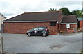
Backwell Playhouse
Located at the far end of a cul-de-sac, Mariners Drive.
Backwell Playhouse is a theatre with 99 seats and an open and flexible performance area, which has been used for plays, dance recitals, music performances, films and presentations.
The Backwell Playhouse Theatre Company has at least three productions a year. An entirely voluntary enterprise, the Playhouse is a charity that aims to advance the education of the public in the Arts,
in particular drama and literature.
Image: © Jaggery
Taken: 13 Jul 2012
0.10 miles
2
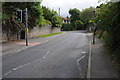
Station Road, Backwall
Pedestrian crossing on Station Road, Backwell.
Image: © Philip Halling
Taken: 10 Sep 2011
0.11 miles
3
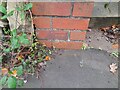
Ordnance Survey Cut Mark
This OS cut mark can be found on the gatepost of No41 Station Road. It marks a point 17.532m above mean sea level.
Image: © Adrian Dust
Taken: 21 Oct 2023
0.12 miles
4
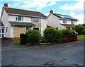
Houses at the far end of Mariners Drive, Backwell
Located near Backwell Playhouse. http://www.geograph.org.uk/photo/3190750
Image: © Jaggery
Taken: 13 Jul 2012
0.13 miles
5
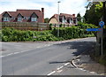
National Cycle Network route 33 signpost, Backwell
The arm on the corner of Westfield Road and Station Road points left along Backwell Common. http://www.geograph.org.uk/photo/3190586
The distances shown are 1¾ miles to Flax Bourton and 7 miles to Bristol.
Image: © Jaggery
Taken: 13 Jul 2012
0.13 miles
7
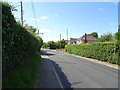
SW end of Backwell Common, Backwell
A lane named Backwell Common heads away from Station Road towards the hamlet of Backwell Common, part of the civil parish of Backwell.
Image: © Jaggery
Taken: 13 Jul 2012
0.15 miles
9
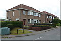
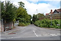
The Crescent, Backwell
Houses at the Station Road end of a cul-de-sac.
Image: © Jaggery
Taken: 13 Jul 2012
0.17 miles
10
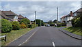
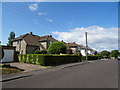
Amberlands Close, Backwell
Viewed from Station Road.
Image: © Jaggery
Taken: 13 Jul 2012
0.18 miles