1
Thornbury, Mile End Farm
On B4061.
Image: © Mike Faherty
Taken: 19 Mar 2017
0.02 miles
2
Mile End Farm, near Upper Morton
Image: © Robin Stott
Taken: 18 Sep 2010
0.02 miles
3
Old Milestone, Upper Morton, B4061
On the North side of the road under a hedge. Inscription is partly readable. Erected by the Bristol Turnpike Trust, probably in the 18ᵗʰ century judging by the use of Roman numerals. The distance to Gloucester is 22 miles, but unless that inscription was below ground, it probably never read it.
Inscription: XII / (Mi)les to / B(r)istol
Milestone National ID: GL_GLBRA22
Image: © Mr Red
Taken: 20 Dec 2022
0.03 miles
4
SW boundary of Upper Morton
Gloucester Road from Thornbury reaches the hamlet of Upper Morton.
Image: © Jaggery
Taken: 2 Jan 2012
0.08 miles
5
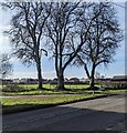
Deciduous trees in winter, Morton, South Gloucestershire
Viewed across Gloucester Road on February 19th 2023.
Image: © Jaggery
Taken: 19 Feb 2023
0.09 miles
6
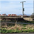
Line spur pole, Newton Hill, Morton, South Gloucestershire
The line spur pole is a rural part of the National Grid electricity supply infrastructure.
Image: © Jaggery
Taken: 19 Feb 2023
0.10 miles
7
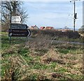
Junction in Morton, South Gloucestershire
From the right, Newton Hill joins Gloucester Road.
Image: © Jaggery
Taken: 19 Feb 2023
0.11 miles
8
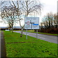
Direction signs on grass, South Gloucestershire
Pointing the way to Shepperdine, Hill, Rockhampton.
Thornbury RFC and Baptist Church.
Rockhampton CC and Thornbury RFC.
CC = Cricket Club. RFC = Rugby Football Club.
Image: © Jaggery
Taken: 19 Feb 2023
0.11 miles
9
Staggered crossroads
This staggered crossroads is at the extreme northern edge of the built-up part of Thornbury, where Butt Lane and Morton Way both join the main road that heads roughly north - south through the town.
Image: © Ruth Riddle
Taken: 7 Dec 2011
0.11 miles
10
Western end of Morton Way, Thornbury
Morton Way approaches the Gloucester Road junction at the northern edge of Thornbury.
Image: © Jaggery
Taken: 2 Jan 2012
0.12 miles


