Old Milestone, Upper Morton, B4061
Introduction
The photograph on this page of Old Milestone, Upper Morton, B4061 by Mr Red as part of the Geograph project.
The Geograph project started in 2005 with the aim of publishing, organising and preserving representative images for every square kilometre of Great Britain, Ireland and the Isle of Man.

There are currently over 7.5m images from over 14,400 individuals and you can help contribute to the project by visiting https://www.geograph.org.uk
Old Milestone, Upper Morton, B4061
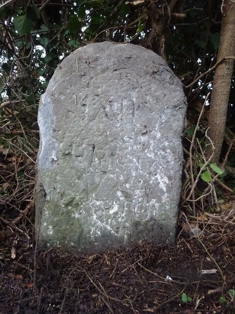
Image: © Mr Red Taken: 20 Dec 2022
On the North side of the road under a hedge. Inscription is partly readable. Erected by the Bristol Turnpike Trust, probably in the 18ᵗʰ century judging by the use of Roman numerals. The distance to Gloucester is 22 miles, but unless that inscription was below ground, it probably never read it. Inscription: XII / (Mi)les to / B(r)istol Milestone National ID: GL_GLBRA22
Images are licensed for reuse under creativecommons.org/licenses/by-sa/2.0
Image Location
Latitude
51.62095
Longitude
-2.512297