IMAGES TAKEN NEAR TO
Hewish, WESTON-SUPER-MARE, BS24 6RW
Introduction
This page details the photographs taken nearby to BS24 6RW by members of the Geograph project.
The Geograph project started in 2005 with the aim of publishing, organising and preserving representative images for every square kilometre of Great Britain, Ireland and the Isle of Man.

There are currently over 7.5m images from over14,400 individuals and you can help contribute to the project by visiting https://www.geograph.org.uk
Image Map
Images are licensed for reuse under creativecommons.org/licenses/by-sa/2.0
Notes
- Clicking on the map will re-center to the selected point.
- The higher the marker number, the further away the image location is from the centre of the postcode.
Image Listing (20 Images Found)
Images are licensed for reuse under creativecommons.org/licenses/by-sa/2.0
Image
Details
Distance
3
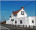
Flavour Exclusive Indian Cuisine, Hewish
Formerly the Golden Phoenix (Chinese) Restaurant, now Flavour Exclusive Indian Cuisine, located alongside the A370 in Hewish, about 2km NE of M5 motorway junction 21 in the east of Weston-super-Mare. The restaurant specialises in curry, balti and tandoori dishes.
Image: © Jaggery
Taken: 23 Jul 2011
0.04 miles
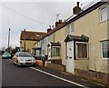
4
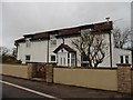
Palmer's Elm, Hewish
The houses on the left face Flavour Exclusive Indian Cuisine Restaurant. http://www.geograph.org.uk/photo/3031489
Image: © Jaggery
Taken: 23 Jul 2011
0.04 miles
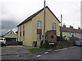
6
Maysgreen Lane, off the A370
This was the original route of the road which became the A370; these houses are now bypassed to the west
Image: © David Smith
Taken: 1 Oct 2021
0.07 miles
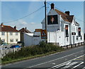
7

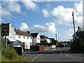
Wick Road reaches Hewish
The road from Wick St Lawrence reaches the A370. The sign shows left for Bristol or right for Weston-super-Mare.
Image: © Jaggery
Taken: 23 Jul 2011
0.07 miles
8
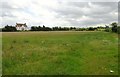
Field between the A370 and Wick Lane
Over this field which may well be cut later in the year for haylage we can see what was once a public house called the Aspen Tree though now it is an Indian restaurant
Image: © Ant Basterfield
Taken: 10 Jul 2016
0.08 miles
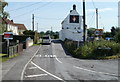
10
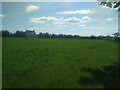
Looking toward The A370
Over the field you can see what was at one time a public house; now it's an Indian restaurant.
Image: © Ant Basterfield
Taken: 12 May 2019
0.10 miles