IMAGES TAKEN NEAR TO
Coker Road, WESTON-SUPER-MARE, BS22 6BX
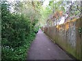
Introduction
This page details the photographs taken nearby to Coker Road, BS22 6BX by members of the Geograph project.
The Geograph project started in 2005 with the aim of publishing, organising and preserving representative images for every square kilometre of Great Britain, Ireland and the Isle of Man.

There are currently over 7.5m images from over14,400 individuals and you can help contribute to the project by visiting https://www.geograph.org.uk
Image Map (Loading...)


Getting Data...Please wait
Leaflet Map data © OpenStreetMap
Images are licensed for reuse under creativecommons.org/licenses/by-sa/2.0
Notes
- Clicking on the map will re-center to the selected point.
- The higher the marker number, the further away the image location is from the centre of the postcode.
Image Listing (49 Images Found)
Images are licensed for reuse under creativecommons.org/licenses/by-sa/2.0
Image
Details
Distance
1
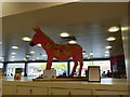
Sainsbury's Donkey - Worle, Weston-super-Mare
Image: © Hazel Stanmore-Richards
Taken: 9 Sep 2010
0.04 miles
2
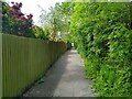
Ricketts Lane looking West
This section of Ricketts Lane from Tavistock Road closed in 1977 due to the construction of the Queen's Way.
Image: © s
Taken: 18 May 2023
0.05 miles
3
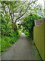
Ricketts Lane looking East
This section of Ricketts Lane from Tavistock Road closed in 1977 due to the construction of the Queen's Way
Image: © s
Taken: 14 May 2023
0.05 miles
4
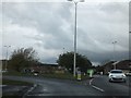
Roundabout on Queen's Way
There is a small boat decorated with flowers on this roundabout, which is on the road to the resort of Sand Bay.
Image: © David Smith
Taken: 20 Apr 2012
0.06 miles
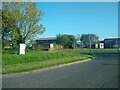
6
Starcross Road looking East
Starcross Road was built in 1982.
Image: © s
Taken: 12 May 2023
0.07 miles
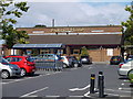
7
North Worle District Centre from Wansbrough Roundabout
North Worle District Centre was built in 1977. The Parish Pump pub was built in 1980. It was named after a 16th century Worle pub with the same name.
Image: © s
Taken: 13 May 2023
0.08 miles
8
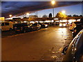
Dusk Shopping
The view on the car park on the Shopping Estate at Worle, Weston Super Mare.
Image: © Gordon Griffiths
Taken: 17 Nov 2012
0.09 miles
9
Ricketts Lane looking East
This section of Ricketts Lane from Tavistock Road closed in 1977 due to the construction of the Queen's Way.
Image: © s
Taken: 12 May 2023
0.09 miles
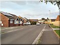
10
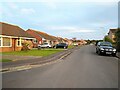
Tavistock Road looking South
Tavistock Road was built in 1966 from the widening of Ricketts Lane. The houses on the left were built in 1982. The houses on the right were built in 1975.
Image: © s
Taken: 12 May 2023
0.09 miles