IMAGES TAKEN NEAR TO
Ladymead, BRISTOL, BS20 7LJ
Introduction
This page details the photographs taken nearby to Ladymead, BS20 7LJ by members of the Geograph project.
The Geograph project started in 2005 with the aim of publishing, organising and preserving representative images for every square kilometre of Great Britain, Ireland and the Isle of Man.

There are currently over 7.5m images from over14,400 individuals and you can help contribute to the project by visiting https://www.geograph.org.uk
Image Map (Loading...)


Getting Data...Please wait
Leaflet Map data © OpenStreetMap
Images are licensed for reuse under creativecommons.org/licenses/by-sa/2.0
Notes
- Clicking on the map will re-center to the selected point.
- The higher the marker number, the further away the image location is from the centre of the postcode.
Image Listing (21 Images Found)
Images are licensed for reuse under creativecommons.org/licenses/by-sa/2.0
Image
Details
Distance
1
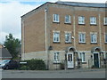
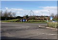
Modern town-houses
These two town-houses form part of a short terrace on Tydeman Road near to its junction with Galingale Way.
Image: © Ruth Riddle
Taken: 10 Jul 2012
0.10 miles
2
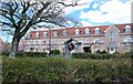
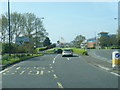
New housing on the outskirts of Portishead, North Somerset
Image: © Anthony O'Neil
Taken: 13 Apr 2009
0.12 miles
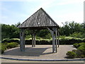
5
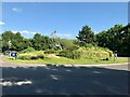
Sail Sculpture on a Roundabout
Traffic island on Wyndham Way (A369).
Image: © David Dixon
Taken: 16 Jul 2021
0.18 miles
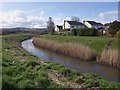
7
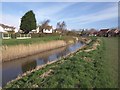
Portbury Ditch
Looking the other way, downstream, along Image, with Heron Gardens on the right.
Image: © Derek Harper
Taken: 1 Apr 2010
0.19 miles
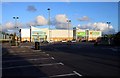
8
Roundabout, Gordano Gate
A sculpture in the form of a sail and mast, reflecting the town crest of a sailing ship, stands in the centre of this roundabout on Wyndham Way.
Image: © Derek Harper
Taken: 1 Apr 2010
0.19 miles
9

Flood water source
The Headwaters of the rhyne ditch. In this weather everything is a flood source and headwater to a stream ephemeral. Before 1996.
Image: © MDS
Taken: Unknown
0.20 miles
10
Portbury Ditch
An unappealing name for the sizable watercourse that drain the Gordano valley and runs through the eastern side of the town. Here, with its banks and a grassy area behind, it forms a natural corridor between housing on Brampton Way (right) and Heron Gardens.
Image: © Derek Harper
Taken: 1 Apr 2010
0.20 miles