IMAGES TAKEN NEAR TO
Tugela Road, BRISTOL, BS13 7BX
Introduction
This page details the photographs taken nearby to Tugela Road, BS13 7BX by members of the Geograph project.
The Geograph project started in 2005 with the aim of publishing, organising and preserving representative images for every square kilometre of Great Britain, Ireland and the Isle of Man.

There are currently over 7.5m images from over14,400 individuals and you can help contribute to the project by visiting https://www.geograph.org.uk
Image Map
Images are licensed for reuse under creativecommons.org/licenses/by-sa/2.0
Notes
- Clicking on the map will re-center to the selected point.
- The higher the marker number, the further away the image location is from the centre of the postcode.
Image Listing (12 Images Found)
Images are licensed for reuse under creativecommons.org/licenses/by-sa/2.0
Image
Details
Distance
1
Ordnance Survey Cut Mark
This OS cut mark can be found on No29 Tugela Road. It marks a point 61.320m above mean sea level.
Image: © Adrian Dust
Taken: 5 Aug 2022
0.04 miles
3
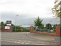
Bedminster Down School, Bristol, from Donald Road
Image: © Trevor Johnson
Taken: 26 Sep 2012
0.14 miles
4
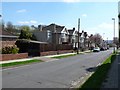
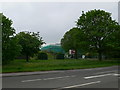
Marguerite Rd
Marguerite Rd is a small residential street on Bedminster Down that runs south east off the main A38.
Image: © Nigel Mykura
Taken: 9 Apr 2010
0.15 miles
5
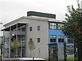
Bedminster Down School, Bristol, from Tyntesfield Road
Image: © Trevor Johnson
Taken: 26 Sep 2012
0.17 miles
6
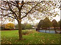
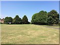
King's Head Lane Park, Bishopsworth
The playground on the right was completed in 2009. The park is mapped as King's Head Park but seems to be known as King's Head Lane Park.
Image: © Derek Harper
Taken: 16 Nov 2013
0.18 miles
7
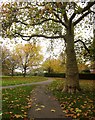
King's Head Lane Park, Bishopsworth
A tree-lined path. By the time you've passed the third tree on the right, you're in Image
Image: © Derek Harper
Taken: 16 Nov 2013
0.18 miles
8
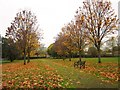
Kings Head Park, Bishopsworth
Seen from the entrance of footpath BCC/493 near Home Farm.
Image: © Derek Harper
Taken: 16 Nov 2013
0.19 miles
10
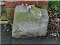
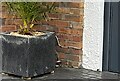
Old Boundary Marker on Highridge Green, Bristol
Parish Boundary Marker on the west side of Highridge Green, Highridge, Bristol, against the front garden gatepost of no.2. Shown on OS maps surveyed in 1882 on the boundary of Bedminster and Long Ashton parishes. From 1894 it was on the boundary of Bedminster Without and Long Ashton and from 1898 Bishopsworth and Long Ashton. Since 1951 it has been completely within the Bristol boundary.
Milestone Society National ID: SO_BRIS26pb
Image: © Roadside Relics
Taken: 7 Jan 2020
0.20 miles