Old Boundary Marker on Highridge Green, Bristol
Introduction
The photograph on this page of Old Boundary Marker on Highridge Green, Bristol by Roadside Relics as part of the Geograph project.
The Geograph project started in 2005 with the aim of publishing, organising and preserving representative images for every square kilometre of Great Britain, Ireland and the Isle of Man.

There are currently over 7.5m images from over 14,400 individuals and you can help contribute to the project by visiting https://www.geograph.org.uk
Old Boundary Marker on Highridge Green, Bristol
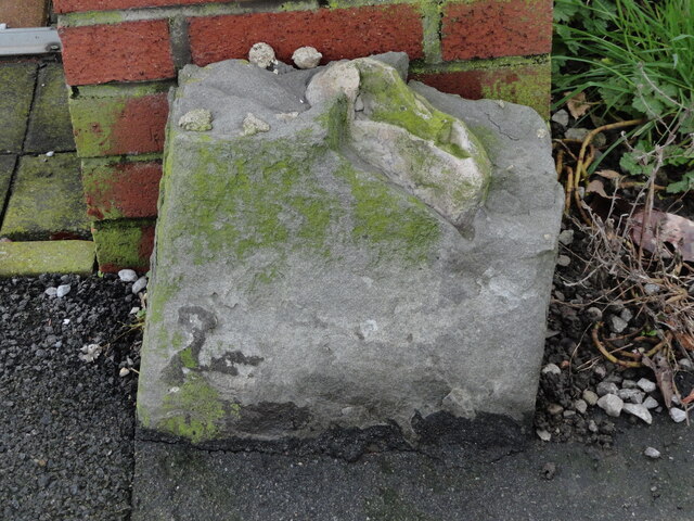
Image: © Roadside Relics Taken: 7 Jan 2020
Parish Boundary Marker on the west side of Highridge Green, Highridge, Bristol, against the front garden gatepost of no.2. Shown on OS maps surveyed in 1882 on the boundary of Bedminster and Long Ashton parishes. From 1894 it was on the boundary of Bedminster Without and Long Ashton and from 1898 Bishopsworth and Long Ashton. Since 1951 it has been completely within the Bristol boundary. Milestone Society National ID: SO_BRIS26pb
Images are licensed for reuse under creativecommons.org/licenses/by-sa/2.0
Image Location
Latitude
51.420706
Longitude
-2.627564