IMAGES TAKEN NEAR TO
Bickerton Close, BRISTOL, BS10 7LH
Introduction
This page details the photographs taken nearby to Bickerton Close, BS10 7LH by members of the Geograph project.
The Geograph project started in 2005 with the aim of publishing, organising and preserving representative images for every square kilometre of Great Britain, Ireland and the Isle of Man.

There are currently over 7.5m images from over14,400 individuals and you can help contribute to the project by visiting https://www.geograph.org.uk
Image Map
Images are licensed for reuse under creativecommons.org/licenses/by-sa/2.0
Notes
- Clicking on the map will re-center to the selected point.
- The higher the marker number, the further away the image location is from the centre of the postcode.
Image Listing (20 Images Found)
Images are licensed for reuse under creativecommons.org/licenses/by-sa/2.0
Image
Details
Distance
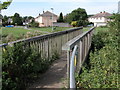
2
Passage Rd
This small green on Passage Rd has been surrounded with large rocks presumably to stop motor vehicle access. It is just off Wick Beck Rd. Only the left most house is in the grid square, the ones at the back are in ST5779.
Image: © Nigel Mykura
Taken: 22 Apr 2011
0.10 miles
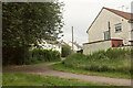
3
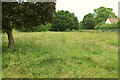
Crow Lane Open Space
The house is on Vaughan Close. The Community Forest Path runs along this side of the Hazel Brook, which the trees on the left border.
Image: © Derek Harper
Taken: 27 Jun 2021
0.14 miles
4
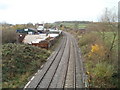
Railway lines west from Wyck Beck Road, Bristol
The view west from the bridge carrying Wyck Beck Road (A4018). A short distance beyond the bend ahead was Henbury railway station, which closed in 1964.
Image: © Jaggery
Taken: 6 Nov 2010
0.14 miles
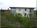
5
Vimpany Close, Henbury
From Crow Lane Open Space.
Image: © Derek Harper
Taken: 27 Jun 2021
0.15 miles
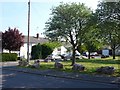
6
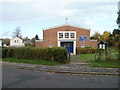
New Kingsland United Reformed Church, Bristol
Located in Henbury, on Passage Road, about 100 metres west of the junction with Wyck Beck Road.
The United Reformed Church began in 1972, an amalgamation of the Congregational and Presbyterian Churches.
Image: © Jaggery
Taken: 6 Nov 2010
0.16 miles
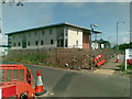
9
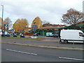
Beaufort Motor Co Ltd, Bristol
Located on the east side of Wyck Beck Road (A4018). Second-hand car sales, MoT test centre, servicing, sale of tyres, exhausts, etc.
Image: © Jaggery
Taken: 6 Nov 2010
0.17 miles
10
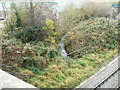
Hazel Brook, Bristol
Viewed from Wyck Beck Road railway bridge. Hazel Brook is a tributary of the River Trym, which it enters at Coombe Dingle after dropping through a steep limestone gorge in the Blaise Castle estate.
Image: © Jaggery
Taken: 6 Nov 2010
0.17 miles