IMAGES TAKEN NEAR TO
Lower Camden, CHISLEHURST, BR7 5HZ
Introduction
This page details the photographs taken nearby to Lower Camden, BR7 5HZ by members of the Geograph project.
The Geograph project started in 2005 with the aim of publishing, organising and preserving representative images for every square kilometre of Great Britain, Ireland and the Isle of Man.

There are currently over 7.5m images from over14,400 individuals and you can help contribute to the project by visiting https://www.geograph.org.uk
Image Map
Images are licensed for reuse under creativecommons.org/licenses/by-sa/2.0
Notes
- Clicking on the map will re-center to the selected point.
- The higher the marker number, the further away the image location is from the centre of the postcode.
Image Listing (51 Images Found)
Images are licensed for reuse under creativecommons.org/licenses/by-sa/2.0
Image
Details
Distance
1
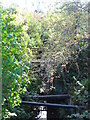
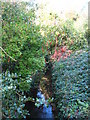
The Kyd Brook east of Lower Camden, BR7 (3)
Image: © Mike Quinn
Taken: 12 Oct 2010
0.02 miles
2
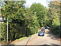
Lane off Lower Camden, BR7
The Kyd Brook passes under the far end of the track - see Image
Image: © Mike Quinn
Taken: 12 Oct 2010
0.02 miles
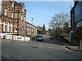
3
Lane off Lower Camden, BR7 (3)
The brick wall in the foreground (right) marks where the Kyd Brook passes under the road - see Image In the middle distance (left) is the Image
Image: © Mike Quinn
Taken: 12 Oct 2010
0.03 miles
4
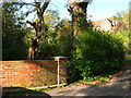
Lane off Lower Camden, BR7 (2)
The brick wall (left) marks where the Kyd Brook passes under the road - see Image
Image: © Mike Quinn
Taken: 12 Oct 2010
0.03 miles
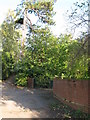
6
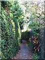
Footpath between Lower Camden and Porrington Close, BR7
Image: © Mike Quinn
Taken: 12 Oct 2010
0.06 miles
7
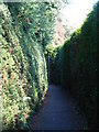
Footpath between Lower Camden and Porrington Close, BR7 (2)
Image: © Mike Quinn
Taken: 12 Oct 2010
0.07 miles
9
The Kyd Brook east of Lower Camden, BR7 (2)
The footbridge in the foreground (right) crosses the stream.
Image: © Mike Quinn
Taken: 12 Oct 2010
0.08 miles
10
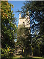
The tower of Christ Church, Lubbock Road, BR7
See Image
Image: © Mike Quinn
Taken: 12 Oct 2010
0.10 miles