IMAGES TAKEN NEAR TO
Penhale Close, ORPINGTON, BR6 9XS
Introduction
This page details the photographs taken nearby to Penhale Close, BR6 9XS by members of the Geograph project.
The Geograph project started in 2005 with the aim of publishing, organising and preserving representative images for every square kilometre of Great Britain, Ireland and the Isle of Man.

There are currently over 7.5m images from over14,400 individuals and you can help contribute to the project by visiting https://www.geograph.org.uk
Image Map
Images are licensed for reuse under creativecommons.org/licenses/by-sa/2.0
Notes
- Clicking on the map will re-center to the selected point.
- The higher the marker number, the further away the image location is from the centre of the postcode.
Image Listing (33 Images Found)
Images are licensed for reuse under creativecommons.org/licenses/by-sa/2.0
Image
Details
Distance
1
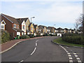
Tregony Road
Part of the development of much of the Orpington Hospital site (see Image), the majority of road names having a Cornish theme.
Image: © Ian Capper
Taken: 12 Feb 2009
0.06 miles
2
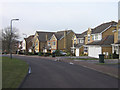
Tregony Road
Part of the development of much of the Orpington Hospital site (see Image), the majority of road names having a Cornish theme.
Image: © Ian Capper
Taken: 12 Feb 2009
0.06 miles
3
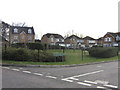
Vancouver Close
Part of the development of much of the Orpington Hospital site (see Image). This road is different from the others, in that the majority of road names have a Cornish theme, whereas this one's name is Canadian, more fitting to the history of the hospital.
Image: © Ian Capper
Taken: 12 Feb 2009
0.09 miles
4
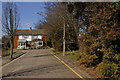
Crown Close
A small development from the 1970s/80s off Crown Road. Running along the right of the photo behind the screen of trees is the main London-Tonbridge railway. To the right of the house in the background, but not accessible, is a coal tax obelisk, no 197 in the list in the link below.
Image: © Ian Capper
Taken: 16 Mar 2010
0.13 miles
5
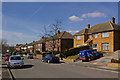
Cloonmore Avenue
In contrast to the western end of the road (see Image, Image and Image), this part of Cloonmore Avenue was not built until the 1950s, with very different style of houses.
Image: © Ian Capper
Taken: 16 Mar 2010
0.14 miles
6
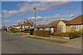
Repton Road
One of a number of roads in southeast Orpington named after public schools, here seen further west than the photo in Image, with a mixture of semis and bungalows. The road off to the right is Haileybury Road.
Image: © Ian Capper
Taken: 15 Mar 2010
0.15 miles
7
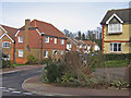
Newlyn Close
Part of the development of much of the Orpington Hospital site (see Image), the majority of road names having a Cornish theme. In the background is the high embankment of the Southeastern main railway line.
Image: © Ian Capper
Taken: 12 Feb 2009
0.16 miles
8
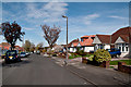
Haileybury Road
One of a number of roads in southeast Orpington named after public schools.
Image: © Ian Capper
Taken: 6 Apr 2011
0.16 miles
9
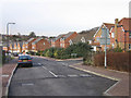
Tregony Road
Part of the development of much of the Orpington Hospital site (see Image), the majority of road names having a Cornish theme. On the right is Newlyn Close.
Image: © Ian Capper
Taken: 12 Feb 2009
0.17 miles