
IMAGES TAKEN NEAR TO
Ridgeway Crescent Gardens, ORPINGTON, BR6 9QH
Introduction
This page details the photographs taken nearby to Ridgeway Crescent Gardens, BR6 9QH by members of the Geograph project.
The Geograph project started in 2005 with the aim of publishing, organising and preserving representative images for every square kilometre of Great Britain, Ireland and the Isle of Man.

There are currently over 7.5m images from over14,400 individuals and you can help contribute to the project by visiting https://www.geograph.org.uk
Image Map
Images are licensed for reuse under creativecommons.org/licenses/by-sa/2.0
Notes
- Clicking on the map will re-center to the selected point.
- The higher the marker number, the further away the image location is from the centre of the postcode.
Image Listing (112 Images Found)
Images are licensed for reuse under creativecommons.org/licenses/by-sa/2.0
Image
Details
Distance
1
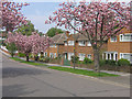
Ridgeway Crescent Gardens
Spring blossom in this 1950s development off Tubbenden Lane.
Image: © Ian Capper
Taken: 21 Apr 2009
0.02 miles
3
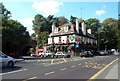
The Maxwell, A232 Station Road, Orpington BR6
To the left of the road is Tubbenden Lane. The A232 goes up the hill to the right, with Orpington station nearby.
Image: © Philip Talmage
Taken: 17 Sep 2005
0.04 miles
4
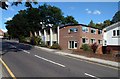
Orpington Baptist Church, BR6
In Tower Road; the A232 is just visible at the left of the picture. Built 1967 with a brick sanctuary added in 1977. No architectural prizes as far as is known ...
Image: © Philip Talmage
Taken: 17 Sep 2005
0.04 miles
5
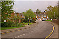
Dalton Close
Dalton Close is built on the site of the original "Tubbenden", for many years owned by the Maxwell family, as commemorated by The Maxwell (see Image), formerly the Maxwell Arms.
One of the Maxwells, Elizabeth, in 1804 married Thomas Young, famed among many and varied things for his establishment of the wave theory of light, his work on the operation of the eye, his work on elasticity, and his pioneering work in relation to the translation of the Rosetta Stone.
For most of the first half of the twentieth century, Tubbenden was the site of Cook's Poultry Farm, run by William Henry Cook. W H Cook was the son of William Cook, the breeder of the Buff Orpington and other Orpington breeds of poultry. A photo shows the entrance to the farm off Tubbenden Lane, including the milestone in Image which still stands the entrance to Dalton Close (see Image).
The name Dalton Close presumably refers to the name Dalton, who were the owners of the manor of Tubbenden in the 16th/17th century.
Image: © Ian Capper
Taken: 16 Apr 2009
0.05 miles
6
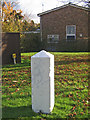
Milestone, Tubbenden Lane
Grade II listed milestone dating from 1779. Inscribed on it (although only just visible due to being repainted, presumably as part of a battle against graffiti) is "XV miles from London Bridge" with the date 1779. The listing particulars suggest that it is situated on the New Cross Turnpike of 1718, but although Tubbenden Lane is clearly an old road (it appears on the early 19th century Ordnance Survey map of the region), it wasn't on any direct route to or from anywhere, so it's not clear why it held any significance as a turnpike route.
For a picture with more context, see Image
Postscript: now restored - see Image
Image: © Ian Capper
Taken: 12 Nov 2008
0.05 miles
7
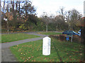
Milestone, Tubbenden Lane
The milestone in Image, with Tubbenden Lane behind. See Image for info on Dalton Close, at whose junction with Tubbenden Lane the milestone stands.
Image: © Ian Capper
Taken: 12 Nov 2008
0.05 miles
8
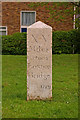
Milestone, Tubbenden Lane
Grade II listed milestone dating from 1779. The listing particulars suggest that it is situated on the New Cross Turnpike of 1718, but although Tubbenden Lane is clearly an old road (it appears on the early 19th century Ordnance Survey map of the region), it wasn't on any direct route to or from anywhere, so it's not clear why it held any significance as a turnpike route.
See Image for photo before restoration and Image for context.
Image: © Ian Capper
Taken: 14 Apr 2009
0.05 miles
9
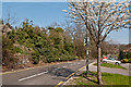
Tubbenden Lane
An old route from Orpington to Farnborough. The wall and line of trees on the left marks the front boundary of a row of large houses built in the 1870s - Sunnyside, Fernbank, The Alchornes, Northolme and Sherlies, of which Sunnyside was notable as the home of George Allen, publisher to John Ruskin. The area was subsequently redeveloped in stages from the 1960s onwards, with Sherlies (the largest plot) being demolished first.
Image: © Ian Capper
Taken: 29 Mar 2012
0.05 miles
10
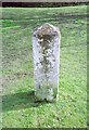
Old Milestone by Tubbenden Lane, Orpington, Bromley parish
Carved stone post by the UC road, in parish of BROMLEY (BROMLEY District), Tubbenden Lane, Orpington, just North of junction with Dalton Close, on wide grass verge behind pavement, on East side of road. Bromley marker, erected by the Sevenoaks turnpike trust in the 19th century.
Inscription reads:-
XV
Miles
from
LONDON
Bridge
1779
Grade II listed.
List Entry Number: 1186829 https://historicengland.org.uk/listing/the-list/list-entry/1186829
Milestone Society National ID: KE_LBR15.
Image: © C Woodward
Taken: 16 Mar 2007
0.05 miles