Milestone, Tubbenden Lane
Introduction
The photograph on this page of Milestone, Tubbenden Lane by Ian Capper as part of the Geograph project.
The Geograph project started in 2005 with the aim of publishing, organising and preserving representative images for every square kilometre of Great Britain, Ireland and the Isle of Man.

There are currently over 7.5m images from over 14,400 individuals and you can help contribute to the project by visiting https://www.geograph.org.uk
Milestone, Tubbenden Lane
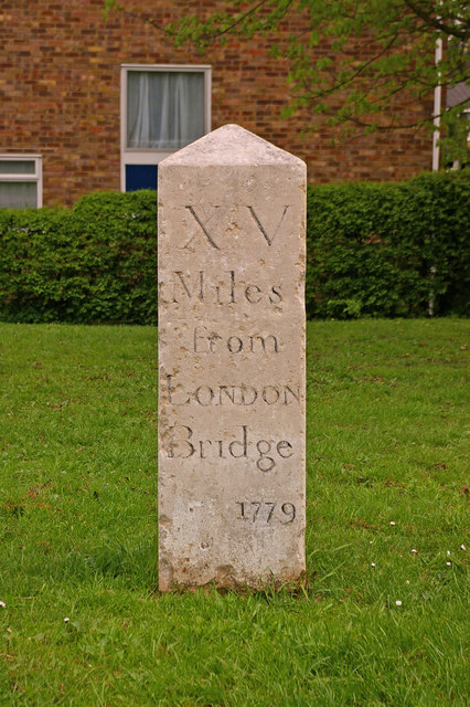
Image: © Ian Capper Taken: 14 Apr 2009
Grade II listed milestone dating from 1779. The listing particulars suggest that it is situated on the New Cross Turnpike of 1718, but although Tubbenden Lane is clearly an old road (it appears on the early 19th century Ordnance Survey map of the region), it wasn't on any direct route to or from anywhere, so it's not clear why it held any significance as a turnpike route. See Image for photo before restoration and Image for context.
Images are licensed for reuse under creativecommons.org/licenses/by-sa/2.0
Image Location
Latitude
51.36964
Longitude
0.086726