
IMAGES TAKEN NEAR TO
Roseberry Gardens, ORPINGTON, BR6 9QE
Introduction
This page details the photographs taken nearby to Roseberry Gardens, BR6 9QE by members of the Geograph project.
The Geograph project started in 2005 with the aim of publishing, organising and preserving representative images for every square kilometre of Great Britain, Ireland and the Isle of Man.

There are currently over 7.5m images from over14,400 individuals and you can help contribute to the project by visiting https://www.geograph.org.uk
Image Map
Images are licensed for reuse under creativecommons.org/licenses/by-sa/2.0
Notes
- Clicking on the map will re-center to the selected point.
- The higher the marker number, the further away the image location is from the centre of the postcode.
Image Listing (55 Images Found)
Images are licensed for reuse under creativecommons.org/licenses/by-sa/2.0
Image
Details
Distance
2
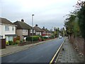
Ridgeway Crescent
Part of the postwar development south of Tubbenden Lane.
Image: © Ian Capper
Taken: 21 Apr 2009
0.06 miles
3
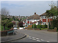
Tubbenden Lane
An old route from Orpington to Farnborough. The houses along this stretch date from immediately before or after the Second World War.
Image: © Ian Capper
Taken: 29 Mar 2012
0.07 miles
4
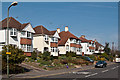
Tubbenden Lane
An old route from Orpington to Farnborough, seen here at its junction with Ruskin Drive. The houses along this stretch date from immediately before or after the Second World War. This chalet style of houses was typical of the builder William Brise (see Image for other examples).
Image: © Ian Capper
Taken: 29 Mar 2012
0.07 miles
5
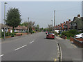
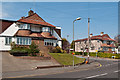
Ridgeway Crescent
Bungalows on the left, "chalet" style houses on the right. This section of the road was developed in the 1930s. Other examples of the chalet style, built by the builder William Brise are in nearby Newstead Avenue (see Image) and in Willett Way, Petts Wood (see Image).
Image: © Ian Capper
Taken: 21 Apr 2009
0.09 miles
6
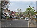
Southcroft Road
1930s road running between Ridgeway Crescent and Tubbenden Lane.
Image: © Ian Capper
Taken: 21 Apr 2009
0.10 miles
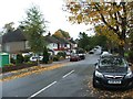
8
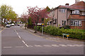
Ruskin Drive
See Image for background. This is the junction of Ruskin Drive and Tubbenden Lane.
Image: © Ian Capper
Taken: 14 Apr 2009
0.10 miles
9

Tubbenden Lane
An old route from Orpington to Farnborough. Most of the houses along this stretch date from immediately before or after the Second World War, although the one on the left of the photo is older - it first appears on the 1896 1:2,500 map as part of Tubbenden Farm.
Image: © Ian Capper
Taken: 29 Mar 2012
0.10 miles
10
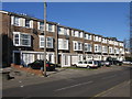
Townhouses in Tubbenden Lane
These houses were built in the late 1970s. Tubbenden Lane is an old route from Orpington to Farnborough, now largely built up.
Image: © Ian Capper
Taken: 8 Feb 2008
0.11 miles