
IMAGES TAKEN NEAR TO
Conifer Close, ORPINGTON, BR6 9QD
Introduction
This page details the photographs taken nearby to Conifer Close, BR6 9QD by members of the Geograph project.
The Geograph project started in 2005 with the aim of publishing, organising and preserving representative images for every square kilometre of Great Britain, Ireland and the Isle of Man.

There are currently over 7.5m images from over14,400 individuals and you can help contribute to the project by visiting https://www.geograph.org.uk
Image Map
Images are licensed for reuse under creativecommons.org/licenses/by-sa/2.0
Notes
- Clicking on the map will re-center to the selected point.
- The higher the marker number, the further away the image location is from the centre of the postcode.
Image Listing (29 Images Found)
Images are licensed for reuse under creativecommons.org/licenses/by-sa/2.0
Image
Details
Distance
2
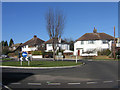
Suburban roundabout, Farnborough
At the junction of Beechcroft Road, Fairview Drive, Southlands Avenue and Melrose Crescent, this roundabout is one of two "asymmetric" ones in the area, clearly included as a "design" element of this pre/post war development rather than for traffic management reasons. (The hand of a designer is clearly demonstrated by the symmetric layout of the area as seen on the map excerpt. The other "balancing" roundabout is at the equivalent junction around 150m to the NNW - even the road names are symmetrical, with Northlands Avenue taking the place of Southlands Avenue!)
Image: © Ian Capper
Taken: 8 Feb 2008
0.07 miles
4
Roundabout on the A21, Farnborough Way
Image: © David Howard
Taken: 12 Jun 2016
0.10 miles
5
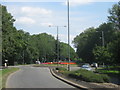
Roundabout on Farnborough Way
The A21 by-passes around Farnborough Village towards Green Street Green.
Tubbenden Lane leads left towards Orpington.
Image: © David Anstiss
Taken: 31 Jul 2011
0.10 miles
6
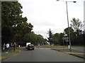
Roundabout on Farnborough Way, Farnborough
Image: © David Howard
Taken: 30 Sep 2012
0.11 miles
8
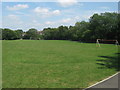
Recreational Ground near Tubbenden Lane
As seen from the London Loop (long distance path) leading from Darrick Wood towards the A21 Farnborough Way (behind the trees in the background).
Image: © David Anstiss
Taken: 31 Jul 2011
0.12 miles
10
St Leonards Rise
The Davis Estate, so called after its builders, was developed either side of the Second World War. This section was built after the war.
Image: © Ian Capper
Taken: 21 Apr 2009
0.14 miles