
IMAGES TAKEN NEAR TO
Sevenoaks Road, ORPINGTON, BR6 9JU
Introduction
This page details the photographs taken nearby to Sevenoaks Road, BR6 9JU by members of the Geograph project.
The Geograph project started in 2005 with the aim of publishing, organising and preserving representative images for every square kilometre of Great Britain, Ireland and the Isle of Man.

There are currently over 7.5m images from over14,400 individuals and you can help contribute to the project by visiting https://www.geograph.org.uk
Image Map
Images are licensed for reuse under creativecommons.org/licenses/by-sa/2.0
Notes
- Clicking on the map will re-center to the selected point.
- The higher the marker number, the further away the image location is from the centre of the postcode.
Image Listing (36 Images Found)
Images are licensed for reuse under creativecommons.org/licenses/by-sa/2.0
Image
Details
Distance
1
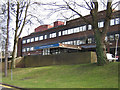
Orpington Hospital
During the First World War, Orpington was the home of what was first known as the Ontario Military Hospital, before becoming No 16 Canadian General Hospital in September 1917. At the time it was said to be one of the largest and most up to date military hospitals in the world. The hospital ceased to be a specific military hospital in September 1919, but was developed into the current Orpington Hospital.
This building, called the Canada Wing in commemoration of the site's history, was completed in 1982 as part of the proposed redevelopment of the entire 39 acre site into a modern district general hospital, providing full services, including A&E. However, revised plans in the 1990s were for a new central hospital to be built in Bromley covering the whole of the district. Despite vigorous campaigning by the then local MP, Ivor Stanbrook, further development of the Orpington Hospital site ceased and most of the site has now been built on with housing. The hospital now covers only a limited range of services, with no A&E, for example.
Ironically, further changes of plans meant that the Bromley Hospital development never came to fruition - instead Farnborough Hospital was redeveloped into the Princess Royal University Hospital, opened in 2003 and funded through a PFI and various sales of land, including no doubt part of this site.
Image: © Ian Capper
Taken: 12 Feb 2009
0.02 miles
2
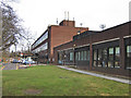
Orpington Hospital
During the First World War, Orpington was the home of what was first known as the Ontario Military Hospital, before becoming No 16 Canadian General Hospital in September 1917. At the time it was said to be one of the largest and most up to date military hospitals in the world. The hospital ceased to be a specific military hospital in September 1919, but was developed into the current Orpington Hospital.
This building, called the Canada Wing in commemoration of the site's history, was completed in 1982 as part of the proposed redevelopment of the entire 39 acre site into a modern district general hospital, providing full services, including A&E. However, revised plans in the 1990s were for a new central hospital to be built in Bromley covering the whole of the district. Despite vigorous campaigning by the then local MP, Ivor Stanbrook, further development of the Orpington Hospital site ceased and most of the site has now been built on with housing. The hospital now covers only a limited range of services, with no A&E, for example.
Ironically, further changes of plans meant that the Bromley Hospital development never came to fruition - instead Farnborough Hospital was redeveloped into the Princess Royal University Hospital, opened in 2003 and funded by through a PFI and various sales of land, including no doubt part of this site.
Image: © Ian Capper
Taken: 12 Feb 2009
0.02 miles
3
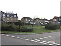
Vancouver Close
Part of the development of much of the Orpington Hospital site (see Image). This road is different from the others, in that the majority of road names have a Cornish theme, whereas this one's name is Canadian, more fitting to the history of the hospital.
Image: © Ian Capper
Taken: 12 Feb 2009
0.06 miles
4
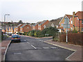
Tregony Road
Part of the development of much of the Orpington Hospital site (see Image), the majority of road names having a Cornish theme. On the right is Newlyn Close.
Image: © Ian Capper
Taken: 12 Feb 2009
0.07 miles
5
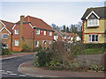
Newlyn Close
Part of the development of much of the Orpington Hospital site (see Image), the majority of road names having a Cornish theme. In the background is the high embankment of the Southeastern main railway line.
Image: © Ian Capper
Taken: 12 Feb 2009
0.08 miles
6
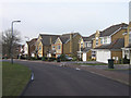
Tregony Road
Part of the development of much of the Orpington Hospital site (see Image), the majority of road names having a Cornish theme.
Image: © Ian Capper
Taken: 12 Feb 2009
0.09 miles
7
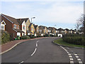
Tregony Road
Part of the development of much of the Orpington Hospital site (see Image), the majority of road names having a Cornish theme.
Image: © Ian Capper
Taken: 12 Feb 2009
0.10 miles
8
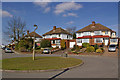
Cloonmore Avenue
Interwar semis. The roundabout is purely ornamental.
Image: © Ian Capper
Taken: 16 Mar 2010
0.11 miles
9
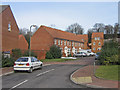
Padstow Close
Part of the development of much of the Orpington Hospital site (see Image), the majority of road names having a Cornish theme. In the background is the high embankment of the Southeastern main railway line.
Image: © Ian Capper
Taken: 12 Feb 2009
0.12 miles
10
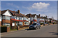
Cloonmore Avenue
Interwar semis. The school sign is for Warren Road School, one of whose entrances is off this road.
Image: © Ian Capper
Taken: 16 Mar 2010
0.12 miles