Orpington Hospital
Introduction
The photograph on this page of Orpington Hospital by Ian Capper as part of the Geograph project.
The Geograph project started in 2005 with the aim of publishing, organising and preserving representative images for every square kilometre of Great Britain, Ireland and the Isle of Man.

There are currently over 7.5m images from over 14,400 individuals and you can help contribute to the project by visiting https://www.geograph.org.uk
Orpington Hospital
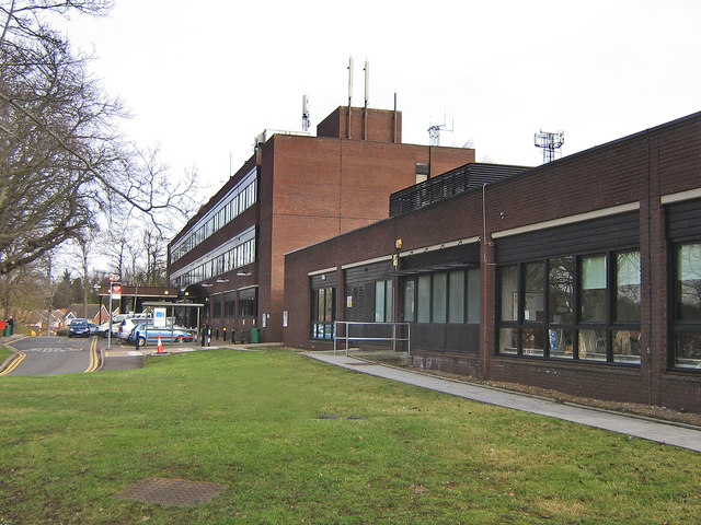
Image: © Ian Capper Taken: 12 Feb 2009
During the First World War, Orpington was the home of what was first known as the Ontario Military Hospital, before becoming No 16 Canadian General Hospital in September 1917. At the time it was said to be one of the largest and most up to date military hospitals in the world. The hospital ceased to be a specific military hospital in September 1919, but was developed into the current Orpington Hospital. This building, called the Canada Wing in commemoration of the site's history, was completed in 1982 as part of the proposed redevelopment of the entire 39 acre site into a modern district general hospital, providing full services, including A&E. However, revised plans in the 1990s were for a new central hospital to be built in Bromley covering the whole of the district. Despite vigorous campaigning by the then local MP, Ivor Stanbrook, further development of the Orpington Hospital site ceased and most of the site has now been built on with housing. The hospital now covers only a limited range of services, with no A&E, for example. Ironically, further changes of plans meant that the Bromley Hospital development never came to fruition - instead Farnborough Hospital was redeveloped into the Princess Royal University Hospital, opened in 2003 and funded by through a PFI and various sales of land, including no doubt part of this site.
Images are licensed for reuse under creativecommons.org/licenses/by-sa/2.0
Image Location
Latitude
51.362386
Longitude
0.094613