
IMAGES TAKEN NEAR TO
Eton Road, ORPINGTON, BR6 9HF
Introduction
This page details the photographs taken nearby to Eton Road, BR6 9HF by members of the Geograph project.
The Geograph project started in 2005 with the aim of publishing, organising and preserving representative images for every square kilometre of Great Britain, Ireland and the Isle of Man.

There are currently over 7.5m images from over14,400 individuals and you can help contribute to the project by visiting https://www.geograph.org.uk
Image Map
Images are licensed for reuse under creativecommons.org/licenses/by-sa/2.0
Notes
- Clicking on the map will re-center to the selected point.
- The higher the marker number, the further away the image location is from the centre of the postcode.
Image Listing (28 Images Found)
Images are licensed for reuse under creativecommons.org/licenses/by-sa/2.0
Image
Details
Distance
1
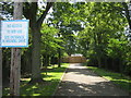
Access lane to Highway Primary School
As seen from Eton Road.
This school is undergoing renovation during the summer school holidays.
Image: © David Anstiss
Taken: 24 Jul 2011
0.03 miles
2
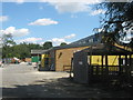
The Highway Primary School, Chelsfield
This school on Arundel Drive, is undergoing re-novation during the summer school holidays.
Image: © David Anstiss
Taken: 24 Jul 2011
0.08 miles
3
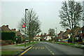
Chelsfield bus stops E and L
On The Highway, the stops are called The Highway School. Regularly served by route R1. Route 654, probably a school service, is also on the board.
Image: © Robin Webster
Taken: 14 Feb 2012
0.09 miles
4
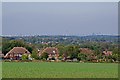
Towards London
Looking from Chelsfield Green across houses in The Highway with central London across the skyline, ranging from the London Eye on the left, The Shard in the centre and the City towers on the right.
Image: © Ian Capper
Taken: 14 Oct 2011
0.11 miles
5
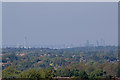
Towards the City of London
Looking from Chelsfield Green across houses in The Highway with the City of London across the skyline, with The Shard on the left and the City towers on the right.
Image: © Ian Capper
Taken: 14 Oct 2011
0.12 miles
6
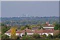
Towards Canary Wharf
Looking from Chelsfield Green across houses in The Highway to the towers of Canary Wharf in the far distance. On the right of the photo is the tower of Orpington College (see Image).
Image: © Ian Capper
Taken: 14 Oct 2011
0.14 miles
7
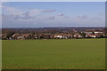
The edge of London!
Taken from the viewpoint on Chelsfield Green (see Image), the field in the foreground marks the start of the (literally!) green belt. The line of houses beyond is in "The Highway" in Orpington, and represents the start of a virtually continuous built up area for over 20 miles across London. No doubt without the introduction of the green belt after the second world war, this field would have been covered in housing, depriving us of this view across south and east London. Visible on the skyline towards the left of the picture is the City of London, and in the centre is Canary Wharf. Although out of the picture to the left, other landmarks visible from here include the BT Tower, the Wembley Arch and Crystal Palace TV transmitter. For the continuation of the view to the right see Image
Image: © Ian Capper
Taken: 4 Feb 2008
0.14 miles
8
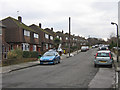
Stowe Road
One of a number of roads in southeast Orpington named after public schools. Note the contrast with housing on the opposite side of the same road (see Image).
Image: © Ian Capper
Taken: 11 Feb 2009
0.14 miles
9
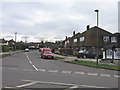
Winchester Road
The street sign is misleading - Charterhouse Road is the one running left to right in front of the photographer's position and with the road joining it here, coming towards the photographer's position, being Winchester Road. Most of the roads in this part of Orpington are named after public schools.
Image: © Ian Capper
Taken: 11 Feb 2009
0.17 miles
10
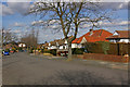
Malvern Road
One of a number of roads in southeast Orpington named after public schools. This is one consists mainly of bungalows. In the distance is Christ Church in Charterhouse Road (see Image).
Image: © Ian Capper
Taken: 15 Mar 2010
0.17 miles