IMAGES TAKEN NEAR TO
Grange Road, ORPINGTON, BR6 8ED
Introduction
This page details the photographs taken nearby to Grange Road, BR6 8ED by members of the Geograph project.
The Geograph project started in 2005 with the aim of publishing, organising and preserving representative images for every square kilometre of Great Britain, Ireland and the Isle of Man.

There are currently over 7.5m images from over14,400 individuals and you can help contribute to the project by visiting https://www.geograph.org.uk
Image Map
Images are licensed for reuse under creativecommons.org/licenses/by-sa/2.0
Notes
- Clicking on the map will re-center to the selected point.
- The higher the marker number, the further away the image location is from the centre of the postcode.
Image Listing (56 Images Found)
Images are licensed for reuse under creativecommons.org/licenses/by-sa/2.0
Image
Details
Distance
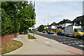
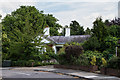
1
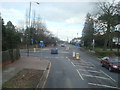
Grange Road
Mainly 1940s/50s(?) housing. The road name refers to a large house, Crofton Grange, situated near the junction of Crofton Road and Crofton Avenue, although much of the road had been developed by the time the Grange itself was demolished in around 1953.
Image: © Ian Capper
Taken: 8 Aug 2013
0.05 miles
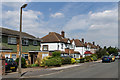
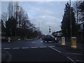
3
Crofton Road/Crofton Avenue junction
The junction of Crofton Avenue with Crofton Road. To add further to the mix the footpath opposite leads through to Crofton Lane, which itself meets Crofton Road at the roundabout near the right hand edge of the photo (see Image).
Image: © Ian Capper
Taken: 29 Mar 2012
0.08 miles
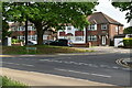
4
Crofton Road, junction with Crofton Lane, Orpington
Image: © Stacey Harris
Taken: 14 Feb 2009
0.09 miles
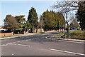
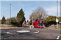
5
Junction of Crofton Road and Crofton Lane
The A232 runs from Ewell in the west to Orpington where it joins the A224.
Image: © David Howard
Taken: 12 Feb 2012
0.09 miles
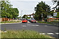
7
Crofton Road/Crofton Lane junction
Seen here at its junction with Crofton Lane. The bus is on Route 208 from Lewisham Station to Orpington Perry Hall Road operated by Stagecoach.
Image: © Ian Capper
Taken: 29 Mar 2012
0.09 miles
8
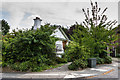
The Lodge
Former lodge to the now demolished Crofton Hall, situated in Crofton Avenue. Dating from c.1860, it is grade II listed - see www.historicengland.org.uk/listing/the-list/list-entry/1068864.
Image: © Ian Capper
Taken: 8 Aug 2013
0.10 miles
9
The Lodge
Former lodge to the now demolished Crofton Hall, situated in Crofton Avenue. Dating from c.1860, it is grade II listed - see www.historicengland.org.uk/listing/the-list/list-entry/1068864.
Image: © Ian Capper
Taken: 8 Aug 2013
0.10 miles