
IMAGES TAKEN NEAR TO
Cathcart Drive, ORPINGTON, BR6 8BX
Introduction
This page details the photographs taken nearby to Cathcart Drive, BR6 8BX by members of the Geograph project.
The Geograph project started in 2005 with the aim of publishing, organising and preserving representative images for every square kilometre of Great Britain, Ireland and the Isle of Man.

There are currently over 7.5m images from over14,400 individuals and you can help contribute to the project by visiting https://www.geograph.org.uk
Image Map
Images are licensed for reuse under creativecommons.org/licenses/by-sa/2.0
Notes
- Clicking on the map will re-center to the selected point.
- The higher the marker number, the further away the image location is from the centre of the postcode.
Image Listing (231 Images Found)
Images are licensed for reuse under creativecommons.org/licenses/by-sa/2.0
Image
Details
Distance
1
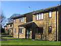
Housing diversity (York Rise)
A series of photos showing the diversity of housing in one gridsquare in outer suburbia. For others in series see http://www.geograph.org.uk/search.php?i=1905481. Any further information, such as building dates and what was on the sites before building, would be appreciated.
A modern development of studio flats at the north end of York Rise, just inside this square.
Image: © Ian Capper
Taken: 8 Feb 2008
0.03 miles
2
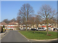
Housing diversity (Cathcart Drive)
A series of photos showing the diversity of housing in one gridsquare in outer suburbia. For others in series see http://www.geograph.org.uk/search.php?i=1905481. Any further information, such as building dates and what was on the sites before building, would be appreciated.
This is Cathcart Drive, built immediately post war close to the railway, which runs behind the houses in this picture. The road bends here, and the resulting space was utilised to provide this triangular green. A similar one was included further along the road (see Image).
Image: © Ian Capper
Taken: 12 Feb 2008
0.03 miles
3
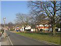
Housing diversity (Cathcart Drive)
A series of photos showing the diversity of housing in one gridsquare in outer suburbia. For others in series see http://www.geograph.org.uk/search.php?i=1905481. Any further information, such as building dates and what was on the sites before building, would be appreciated.
This is Cathcart Drive, built immediately post war close to the railway (the cutting for which is marked by the line of trees in the background). The shape of the site gave room for two pleasant triangular greens, of which this is one (see Image for the other).
Image: © Ian Capper
Taken: 12 Feb 2008
0.04 miles
5
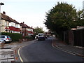
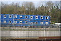
Cathcart Drive, Orpington
Leads from Andover Road to Yeovil Close.
Image: © David Anstiss
Taken: 16 Oct 2011
0.07 miles
6

Railway lines towards Orpington
As seen from Image
Many lines from central London head towards Orpington (via Bromley or Hither Green).They head towards Orpington Station (in the background).
Note: the station is very very quiet this Sunday, due to the fact of engineering works from here to Knockholt. Resulting in passengers taking Rail Replacement buses for the day!
Image: © David Anstiss
Taken: 16 Oct 2011
0.07 miles


9
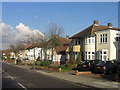
Housing diversity (Andover Road)
A series of photos showing the diversity of housing in one gridsquare in outer suburbia. For others in series see http://www.geograph.org.uk/search.php?i=1905481. Any further information, such as building dates and what was on the sites before building, would be appreciated.
These semis are in Andover Road, to the west of the railway. Looking at the 1940 1 inch map at http://www.npemap.org.uk/tiles/map.html#546,166,1, these particular houses were already built by then, but what appears on the ground to be a similar development behind Andover Road, in Cathcart Drive, is still blank, with Andover Road itself only being partly developed. Unless the map was not fully up to date, this suggests that building either continued through the early part of the war, or even immediately post war, using similar “off the shelf” designs.
Image: © Ian Capper
Taken: 15 Nov 2007
0.08 miles
10
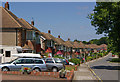
Cathcart Drive
A line of 1950s semi-detached houses.
Image: © Ian Capper
Taken: 16 Jun 2010
0.08 miles