IMAGES TAKEN NEAR TO
Cherrycot Rise, ORPINGTON, BR6 7DL
Introduction
This page details the photographs taken nearby to Cherrycot Rise, BR6 7DL by members of the Geograph project.
The Geograph project started in 2005 with the aim of publishing, organising and preserving representative images for every square kilometre of Great Britain, Ireland and the Isle of Man.

There are currently over 7.5m images from over14,400 individuals and you can help contribute to the project by visiting https://www.geograph.org.uk
Image Map
Images are licensed for reuse under creativecommons.org/licenses/by-sa/2.0
Notes
- Clicking on the map will re-center to the selected point.
- The higher the marker number, the further away the image location is from the centre of the postcode.
Image Listing (35 Images Found)
Images are licensed for reuse under creativecommons.org/licenses/by-sa/2.0
Image
Details
Distance
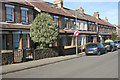
2
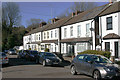
Woodman PH & Village Hall Farnborough High St BR6
Image: © Philip Talmage
Taken: 17 Sep 2005
0.11 miles
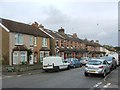
3
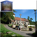
St Giles Church, Farnborough, Kent BR6
The parish website is at http://www.farnborough-kent-parish.org.uk/index.htm
Image: © Philip Talmage
Taken: 17 Sep 2005
0.11 miles
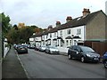
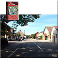
7
Gladstone Road, Farnborough (Kent)
Taken between the junctions with Peel Road and Palmerston Road.
Image: © David Kemp
Taken: 7 Mar 2015
0.14 miles
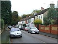
8
Recreational Ground near Tubbenden Lane
As seen from the London Loop (long distance path) leading from Darrick Wood towards the A21 Farnborough Way (behind the trees in the background).
Image: © David Anstiss
Taken: 31 Jul 2011
0.15 miles
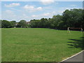
9
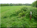
The London LOOP on Tubbenden Meadow
Tubbenden Meadow was part of Crofton Manor, mentioned in the Domesday Book. In 1553 Edward VI gave to St Thomas’s Hospital who owned it for over 400 years. The ancient boundaries between Farnborough and Orpington parishes crossed from right to left. The Orpington 1841 Tithe map showed shows this was part of Great Darrick Field where the farmer John Westbrook grew arable crops. It was bought by Kent County Council in 1956 and part of it was used to build new schools.
It is now a wildflower meadow with fine views towards Chelsfield, Halstead and Knockholt. The London LOOP drops down the slope here on its way from Darrick Wood to Farnborough Village.
Image: © Marathon
Taken: 23 Apr 2014
0.16 miles
10
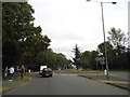
Roundabout on Farnborough Way, Farnborough
Image: © David Howard
Taken: 30 Sep 2012
0.16 miles