
IMAGES TAKEN NEAR TO
Lodge Crescent, ORPINGTON, BR6 0QE
Introduction
This page details the photographs taken nearby to Lodge Crescent, BR6 0QE by members of the Geograph project.
The Geograph project started in 2005 with the aim of publishing, organising and preserving representative images for every square kilometre of Great Britain, Ireland and the Isle of Man.

There are currently over 7.5m images from over14,400 individuals and you can help contribute to the project by visiting https://www.geograph.org.uk
Image Map
Images are licensed for reuse under creativecommons.org/licenses/by-sa/2.0
Notes
- Clicking on the map will re-center to the selected point.
- The higher the marker number, the further away the image location is from the centre of the postcode.
Image Listing (331 Images Found)
Images are licensed for reuse under creativecommons.org/licenses/by-sa/2.0
Image
Details
Distance
1
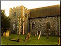
"All Saints"
The Parish Church, "All Saints", stands upon pre-Norman foundations. Mentioned in the Domesday Book, it is Early English in style, but some Saxon work is visible. It was endowed by the Archbishop of Canterbury in 1173. The tower and steeple were damaged by a storm in 1771. The rebuilt steeple was struck by lightning in 1809, and it was not replaced. The church was greatly enlarged in 1957. The present Vicar is the Reverend Alan Mustoe
Image: © Tom fitton
Taken: 1 Mar 2007
0.07 miles
2
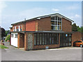
Church Hall, All Saints' Church, Orpington
Built in 1957
Image: © Ian Capper
Taken: 14 May 2008
0.07 miles
3
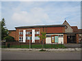
All Saints, Orpington: church hall
The hall is adjacent to the church on Bark Hart Road.
Image: © Stephen Craven
Taken: 24 Sep 2013
0.07 miles
4
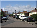
Upland Road
Part of a small high density pre-war estate above Orpington High Street. In the background is the tower of Orpington College (Image).
Image: © Ian Capper
Taken: 24 Apr 2008
0.07 miles
5
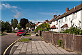
Lodge Crescent
Housing from the 1930s/1940s built on the site of Court Lodge.
Image: © Ian Capper
Taken: 12 Jul 2012
0.07 miles
6
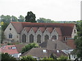
All Saints Church, Orpington
The Church, has pre-Norman foundations.It is Early English in style, but some Saxon work is visible. It was endowed by the Archbishop of Canterbury in 1173. The tower and steeple were damaged by a storm in 1771. The rebuilt steeple was struck by lightning in 1809, and it was not replaced. The church was greatly enlarged in 1957. The extension was designed by Geddes Hyslop and was created by removing most of the south wall and constructing a new large church at right angles to the original. The original building is referred to as "The Old Church" and the extension as "The New Church"
Image: © Richard Rogerson
Taken: 14 Jun 2011
0.07 miles
7
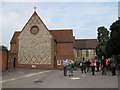
All Saints, Orpington: south end
Another, more local contributor gives a detailed history of this church at Image This view is of the south end of the 1957 extension (the present chancel).
Image: © Stephen Craven
Taken: 24 Sep 2013
0.07 miles
8
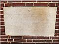
All Saints, Orpington: datestone
The datestone records the laying of the foundation by the Duchess of Kent in 1957. for context, see Image
Image: © Stephen Craven
Taken: 24 Sep 2013
0.07 miles
9
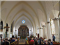
All Saints, Orpington: interior
Interior of the 1957 nave and chancel Image
Image: © Stephen Craven
Taken: 24 Sep 2013
0.07 miles
10
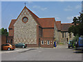
All Saints' Church, Orpington
This is the south extension of the church built in 1957.
Image: © Ian Capper
Taken: 14 May 2008
0.08 miles