IMAGES TAKEN NEAR TO
Chislehurst Road, ORPINGTON, BR6 0DT
Introduction
This page details the photographs taken nearby to Chislehurst Road, BR6 0DT by members of the Geograph project.
The Geograph project started in 2005 with the aim of publishing, organising and preserving representative images for every square kilometre of Great Britain, Ireland and the Isle of Man.

There are currently over 7.5m images from over14,400 individuals and you can help contribute to the project by visiting https://www.geograph.org.uk
Image Map (Loading...)


Getting Data...Please wait
Leaflet Map data © OpenStreetMap
Images are licensed for reuse under creativecommons.org/licenses/by-sa/2.0
Notes
- Clicking on the map will re-center to the selected point.
- The higher the marker number, the further away the image location is from the centre of the postcode.
Image Listing (39 Images Found)
Images are licensed for reuse under creativecommons.org/licenses/by-sa/2.0
Image
Details
Distance
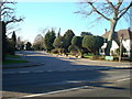
1
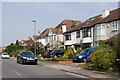
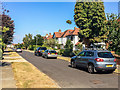
Grosvenor Road
A road running parallel to Chislehurst Road.
Image: © Ian Capper
Taken: 25 Mar 2011
0.04 miles
4
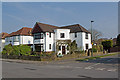
Grosvenor Road
An unusual house at the junction with Elysian Avenue.
Image: © Ian Capper
Taken: 25 Mar 2011
0.07 miles
5
Grosvenor Road
A road running parallel to Chislehurst Road.
Image: © Ian Capper
Taken: 25 Mar 2011
0.08 miles
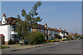
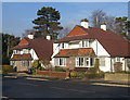
7
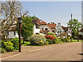
The Chenies
Various builders were involved in developing Petts Wood in the late 1920s/1930s, and provided they subscribed to the overall vision of Basil Scruby, the man behind the concept of Petts Wood as a green field "garden suburb", they were allowed to leave their individual mark. One of the best known builders involved was Noel Rees, typified by his "Tudor" style, and The Chenies is the pinnacle of his contribution. It is a private cul-de sac of 29 houses, each similar but different in style. In 1982 it was designated a Conservation Area. The name of the road comes from the village of the same name in Buckinghamshire, and was suggested by one of the first residents of the road who had moved in from that county.
Image: © Ian Capper
Taken: 6 May 2008
0.09 miles
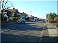
8
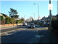
Sutherland Avenue
A road largely developed in the 1930s.
Image: © Ian Capper
Taken: 14 Sep 2016
0.12 miles
9
Sutherland Avenue
A road largely developed in the 1930s.
Image: © Ian Capper
Taken: 14 Sep 2016
0.12 miles
10
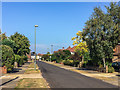
Willett Way
Chalet style semi-detached houses built by the builder William Brise in the 1930s, who developed the southern end of Willett Way and four cul-de-sacs running off Willett Way, all in this style.
Image: © Ian Capper
Taken: 8 Jan 2009
0.12 miles