
IMAGES TAKEN NEAR TO
Cray Avenue, ORPINGTON, BR5 3QB
Introduction
This page details the photographs taken nearby to Cray Avenue, BR5 3QB by members of the Geograph project.
The Geograph project started in 2005 with the aim of publishing, organising and preserving representative images for every square kilometre of Great Britain, Ireland and the Isle of Man.

There are currently over 7.5m images from over14,400 individuals and you can help contribute to the project by visiting https://www.geograph.org.uk
Image Map
Images are licensed for reuse under creativecommons.org/licenses/by-sa/2.0
Notes
- Clicking on the map will re-center to the selected point.
- The higher the marker number, the further away the image location is from the centre of the postcode.
Image Listing (86 Images Found)
Images are licensed for reuse under creativecommons.org/licenses/by-sa/2.0
Image
Details
Distance
1
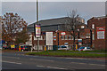
Lagoon Road
The A224 Cray Avenue was built in the 1930s as one of the London arterial roads linking the A20 with the A21. This stretch was largely put to light industrial use, although at this particular point there was a large Olympic size open air swimming pool, built in 1933, which was a popular destination at the time with Londoners arriving by train at nearby St Mary Cray Station. But it closed in 1939 after the start of the war and bomb damage meant it never reopened. The site was subsequently redeveloped for light industrial use (the outline of the pool itself is still discernible as a large warehouse set at an angle to the other buildings), with the name of this access road commemorating its former purpose.
Image: © Ian Capper
Taken: 16 Nov 2011
0.07 miles
2
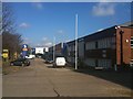
Industrial Estate, Cray Avenue, Orpington
Image: © Stacey Harris
Taken: 20 Feb 2010
0.07 miles
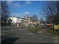
4
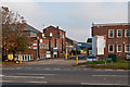
Lagoon Road
The A224 Cray Avenue was built in the 1930s as one of the London arterial roads linking the A20 with the A21. This stretch was largely put to light industrial use, although at this particular point there was a large Olympic size open air swimming pool, built in 1933, which was a popular destination at the time with Londoners arriving by train at nearby St Mary Cray Station. But it closed in 1939 after the start of the war and bomb damage meant it never reopened. The site was subsequently redeveloped for light industrial use (the outline of the pool itself is still discernible as a large warehouse set at an angle to the other buildings - appropriately the blue building in the background of this photo), with the name of this access road commemorating its former purpose.
Image: © Ian Capper
Taken: 16 Nov 2011
0.08 miles
5
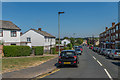
Stanley Way
Road linking Marion Crescent with Cray Avenue.
Image: © Ian Capper
Taken: 17 Aug 2016
0.09 miles
6
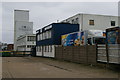
Allied Bakeries, Cray Avenue, Orpington
The further building, with its central pylon structure reminiscent of Charles Holden's interwar tube stations, presumably dates from this road's development in the 1930s as an arterial road fringed by light industry.
Image: © Christopher Hilton
Taken: 2 Mar 2014
0.10 miles
7
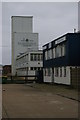
Allied Bakeries, Cray Avenue, Orpington
The further building, with its central pylon structure reminiscent of Charles Holden's interwar tube stations, presumably dates from this road's development in the 1930s as an arterial road fringed by light industry.
Image: © Christopher Hilton
Taken: 2 Mar 2014
0.10 miles
8
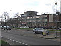
Sun Chemical, Orpington
One of a number of factories along Cray Avenue, an interwar arterial road. Sun Chemicals is the world's largest producer of printing inks and pigments.
Image: © Ian Capper
Taken: 27 Feb 2008
0.10 miles
9
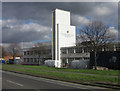
Allied Bakeries, Orpington
Originally the Tip Top Bakery, this bakery in Cray Avenue was built in 1939 and was designed by Sir Alexander Gibb and Partners. It is now part of the Allied Bakeries division of Associated British Foods.
Image: © Ian Capper
Taken: 27 Feb 2008
0.11 miles
10
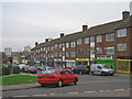
Stanley Way shops
Part of a parade of local shops in the "Robin Hood" estate in Poverest. In the background are Horton and Alkham Towers in St Mary Cray.
Image: © Ian Capper
Taken: 30 Oct 2009
0.11 miles