Lagoon Road
Introduction
The photograph on this page of Lagoon Road by Ian Capper as part of the Geograph project.
The Geograph project started in 2005 with the aim of publishing, organising and preserving representative images for every square kilometre of Great Britain, Ireland and the Isle of Man.

There are currently over 7.5m images from over 14,400 individuals and you can help contribute to the project by visiting https://www.geograph.org.uk
Lagoon Road
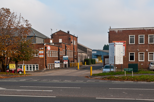
Image: © Ian Capper Taken: 16 Nov 2011
The A224 Cray Avenue was built in the 1930s as one of the London arterial roads linking the A20 with the A21. This stretch was largely put to light industrial use, although at this particular point there was a large Olympic size open air swimming pool, built in 1933, which was a popular destination at the time with Londoners arriving by train at nearby St Mary Cray Station. But it closed in 1939 after the start of the war and bomb damage meant it never reopened. The site was subsequently redeveloped for light industrial use (the outline of the pool itself is still discernible as a large warehouse set at an angle to the other buildings - appropriately the blue building in the background of this photo), with the name of this access road commemorating its former purpose.
Images are licensed for reuse under creativecommons.org/licenses/by-sa/2.0
Image Location
Latitude
51.390855
Longitude
0.111322