
IMAGES TAKEN NEAR TO
Lynmouth Rise, ORPINGTON, BR5 2EJ
Introduction
This page details the photographs taken nearby to Lynmouth Rise, BR5 2EJ by members of the Geograph project.
The Geograph project started in 2005 with the aim of publishing, organising and preserving representative images for every square kilometre of Great Britain, Ireland and the Isle of Man.

There are currently over 7.5m images from over14,400 individuals and you can help contribute to the project by visiting https://www.geograph.org.uk
Image Map
Images are licensed for reuse under creativecommons.org/licenses/by-sa/2.0
Notes
- Clicking on the map will re-center to the selected point.
- The higher the marker number, the further away the image location is from the centre of the postcode.
Image Listing (86 Images Found)
Images are licensed for reuse under creativecommons.org/licenses/by-sa/2.0
Image
Details
Distance
1
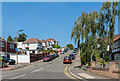
Lynton Avenue
Largely 1930s housing in a road leading up to Furzehill Square and St Mary Cray Station.
Image: © Ian Capper
Taken: 17 Aug 2016
0.03 miles
2
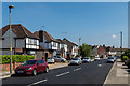
Lynton Avenue
1930s housing in a road linking Sidmouth Road and Cray Valley Road and then Stanley Way.
Image: © Ian Capper
Taken: 17 Aug 2016
0.04 miles
3
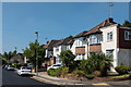
Lynton Avenue
1930s housing in a road linking Sidmouth Road and Cray Valley Road and then Stanley Way.
Image: © Ian Capper
Taken: 17 Aug 2016
0.05 miles
4
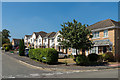
Furzehill Square
Originally called Station Square, referring to its situation alongside the southern entrance to St Mary Cray Station, the road was laid out in the late 1940s, but old maps show it to have been undeveloped until the late 1960s or early 1970s; the current housing dates from the mid 1990s.
Image: © Ian Capper
Taken: 17 Aug 2016
0.05 miles
5
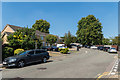
Furzehill Square
Originally called Station Square, referring to its situation alongside the southern entrance to St Mary Cray Station, the road was laid out in the late 1940s, but old maps show it to have been undeveloped until the late 1960s or early 1970s; the current housing dates from the mid 1990s.
Image: © Ian Capper
Taken: 17 Aug 2016
0.07 miles
6
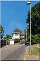
Sidmouth Road
The top end of Sidmouth Road. To the right of the house is a footpath leading to St Mary Cray Station. The 1945 Kent 6" map, based on a 1938 revision, shows an outline of Sidmouth Road itself continuing through to the station; however given that the footpath consists of steps, it was presumably concluded that it would be too steep for the final section to be a road.
Image: © Ian Capper
Taken: 17 Aug 2016
0.07 miles
7
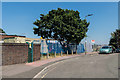
Furzehill Square
Alongside the southern access to St Mary Cray Station off Furzehill Square.
Image: © Ian Capper
Taken: 17 Aug 2016
0.08 miles
8
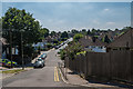
Sidmouth Road
Looking down Sidmouth Road from its northern end, towards its junction with Lynton Avenue in the middle distance and Cray Valley Road in the background.
Image: © Ian Capper
Taken: 17 Aug 2016
0.08 miles
10
Amherst Drive
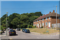
The earliest section of Amherst Drive, coming off Sidmouth Road. In the background is a patch of woodland, the remnant of a much more extensive woodland, Church Hill Wood, on which much of this area was developed.
Image: © Ian Capper
Taken: 17 Aug 2016
0.09 miles