
IMAGES TAKEN NEAR TO
Hayfield Road, ORPINGTON, BR5 2DW
Introduction
This page details the photographs taken nearby to Hayfield Road, BR5 2DW by members of the Geograph project.
The Geograph project started in 2005 with the aim of publishing, organising and preserving representative images for every square kilometre of Great Britain, Ireland and the Isle of Man.

There are currently over 7.5m images from over14,400 individuals and you can help contribute to the project by visiting https://www.geograph.org.uk
Image Map
Images are licensed for reuse under creativecommons.org/licenses/by-sa/2.0
Notes
- Clicking on the map will re-center to the selected point.
- The higher the marker number, the further away the image location is from the centre of the postcode.
Image Listing (71 Images Found)
Images are licensed for reuse under creativecommons.org/licenses/by-sa/2.0
Image
Details
Distance
1
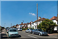
Hayfield Road
Late 1920s or early 1930s housing built in to cut part of the corner of a large bend in the former Poverest Road (now Marion Crescent and part of Cray Valley Road).
Image: © Ian Capper
Taken: 17 Aug 2016
0.01 miles
2
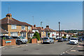
Hayfield Road
Late 1920s or early 1930s housing built in to cut part of the corner of a large bend in the former Poverest Road (now Marion Crescent and part of Cray Valley Road).
Image: © Ian Capper
Taken: 17 Aug 2016
0.01 miles
3
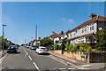
Hayfield Road
Late 1920s or early 1930s housing built in to cut part of the corner of a large bend in the former Poverest Road (now Marion Crescent and part of Cray Valley Road).
Image: © Ian Capper
Taken: 17 Aug 2016
0.02 miles
4
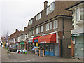
Marion Crescent shops
Part of a parade of local shops in the "Robin Hood" estate in Poverest.
Image: © Ian Capper
Taken: 30 Oct 2009
0.05 miles
5
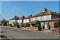
Hayfield Road
Late 1920s or early 1930s housing built in to cut part of the corner of a large bend in the former Poverest Road (now Marion Crescent and part of Cray Valley Road).
Image: © Ian Capper
Taken: 17 Aug 2016
0.06 miles
6
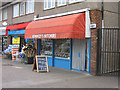
Kennedys Butchers, Marion Crescent
A butchers shop in the parade in Image
Image: © Ian Capper
Taken: 30 Oct 2009
0.06 miles
7
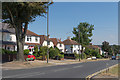
Poverest Road
Road linking St Mary Cray with Petts Wood. Old maps show a narrow lane leading from St Mary Cray to Poverest Farm, situated where Poverest Baptist Church (see Image) now stands. However, although the present road followed the route of part of this lane, the section here was on the route of a footpath, the original lane following the route of what is now Marion Crescent.
The area was developed before or after the Second World War, although exact timing is unclear: the 1944 Kent XVI NE 6" map based on 1938 revisions has housing shown in outline, whereas the 1946 London Sheet T also based on 1938 revisions still shows open countryside. The former map shows this section as Sherwood Road, consistent with the Robin Hood theme of much of the area, with the Poverest Road name still being applied to the then largely undeveloped Marion Crescent. By the 1960s, the names had changed, presumably reflecting the through road status of Poverest Road.
Image: © Ian Capper
Taken: 17 Aug 2016
0.06 miles
8
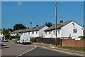
Marion Crescent
Post war housing in Marion Crescent, built on what was part of the original Poverest Road before that name was transferred to a new more direct road on the line of a former footpath (see Image).
Image: © Ian Capper
Taken: 17 Aug 2016
0.06 miles
9
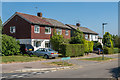
Marion Crescent
Post war housing in Marion Crescent, built on what was part of the original Poverest Road before that name was transferred to a new more direct road on the line of a former footpath (see Image).
Image: © Ian Capper
Taken: 17 Aug 2016
0.06 miles
10
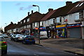
Shops in Marion Crescent
The post office shown on the map is in the shop with the yellow frontage.
Image: © David Martin
Taken: 11 Oct 2014
0.06 miles