IMAGES TAKEN NEAR TO
Hastings Road, BROMLEY, BR2 8QB
Introduction
This page details the photographs taken nearby to Hastings Road, BR2 8QB by members of the Geograph project.
The Geograph project started in 2005 with the aim of publishing, organising and preserving representative images for every square kilometre of Great Britain, Ireland and the Isle of Man.

There are currently over 7.5m images from over14,400 individuals and you can help contribute to the project by visiting https://www.geograph.org.uk
Image Map
Images are licensed for reuse under creativecommons.org/licenses/by-sa/2.0
Notes
- Clicking on the map will re-center to the selected point.
- The higher the marker number, the further away the image location is from the centre of the postcode.
Image Listing (38 Images Found)
Images are licensed for reuse under creativecommons.org/licenses/by-sa/2.0
Image
Details
Distance
2
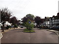
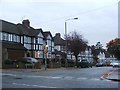
Road island on Beverley Road
This road leads from Gravel Road towards Hastings Road.
The island is a traffic calming measure to slow the traffic down.
Image: © David Anstiss
Taken: 9 Oct 2011
0.09 miles
3
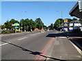
A232 Croydon Road BR2 junction with A233
Looking east; Oakley Road to the north, Westerham Road to the south. A Wyevale garden centre is northwest of the crossroads, with a Jet filling station to the southwest. The site of the former pub (The Keston Mark) southeast of the crossroads is being redeveloped for "exclusive" dwellings (i.e. anyone, presumably, with the requisite dosh).
Image: © Philip Talmage
Taken: 31 Aug 2005
0.09 miles
4
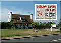
Oakley Hotel for Cats, Oakley Road BR2
(inset: the sign)
Image: © Philip Talmage
Taken: 31 Aug 2005
0.09 miles
5
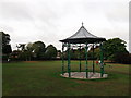
Pavilion in Hollydale Recreational Grounds
This pavilion/shelter is at the higher part of the triangular open-space within Keston Mark.
Image: © David Anstiss
Taken: 9 Oct 2011
0.12 miles
6
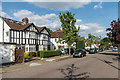
Beverley Road
1930s semis in a road linking Gravel Road with Hastings Road.
Image: © Ian Capper
Taken: 24 May 2017
0.13 miles
7

30 limit on A21
Up to this point, a 40 limit.
Image: © Robin Webster
Taken: 30 Oct 2011
0.13 miles
8
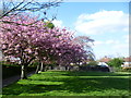
Cherry blossom in Hollydale Recreation Ground
Hollydale Recreation Ground is formed from the former grounds of Hollydale, an 18th century house. The local council bought some of the land and mansion in 1933, and the house was demolished at this time. By 1936, the northern and eastern parkland had been extensively developed for housing, but the lake and some woodland around it survived and forms the recreation ground seen today.
For more information on the park see http://www.londongardensonline.org.uk/gardens-online-record.asp?ID=BRO040
Image: © Marathon
Taken: 9 Apr 2014
0.14 miles
9
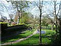
Hollydale Recreation Ground
Hollydale Recreation Ground is formed from the former grounds of Hollydale, an 18th century house. The local council bought some of the land and mansion in 1933, and the house was demolished at this time. By 1936, the northern and eastern parkland had been extensively developed for housing, but the lake and some woodland around it survived and forms the recreation ground seen today.
For more information on the park see http://www.londongardensonline.org.uk/gardens-online-record.asp?ID=BRO040
This view is from the dam of the lake.
Image: © Marathon
Taken: 9 Apr 2014
0.16 miles