IMAGES TAKEN NEAR TO
Ethelbert Close, BROMLEY, BR1 1JB
Introduction
This page details the photographs taken nearby to Ethelbert Close, BR1 1JB by members of the Geograph project.
The Geograph project started in 2005 with the aim of publishing, organising and preserving representative images for every square kilometre of Great Britain, Ireland and the Isle of Man.

There are currently over 7.5m images from over14,400 individuals and you can help contribute to the project by visiting https://www.geograph.org.uk
Image Map
Images are licensed for reuse under creativecommons.org/licenses/by-sa/2.0
Notes
- Clicking on the map will re-center to the selected point.
- The higher the marker number, the further away the image location is from the centre of the postcode.
Image Listing (218 Images Found)
Images are licensed for reuse under creativecommons.org/licenses/by-sa/2.0
Image
Details
Distance
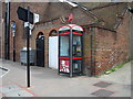
1
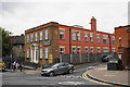
Bromley Town Church
An independent church which avoids being labelled with any denomination. It hosts the UK headquarters of the World Trumpet Mission, which emphasises the urgency of revival and evangelism before the Day of the Lord. It is viewed here from High Street.
Image: © Bill Boaden
Taken: 10 Oct 2015
0.02 miles
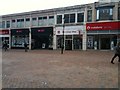
6
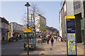
High Street, Bromley
From this point northwards Bromley's High Street is pedestrianised and most of the major retailers are found in this area.
Image: © Stephen McKay
Taken: 27 Mar 2017
0.04 miles
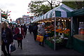
7
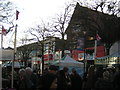
Christmas market, Bromley High Street
Image: © Christopher Hilton
Taken: 22 Dec 2011
0.04 miles
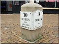
9
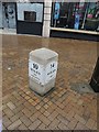
Old Milestone by High Street, Bromley
Metal plate attached to stone post by the UC road (was A21), in parish of BROMLEY (BROMLEY District), High Street, at Southern end of pedestrian area, 40m from junction with Ethelbert Road, in paved area, on West side of road. Bromley marker, erected by the New Cross turnpike trust in the 20th century.
Inscription reads:-
: 10 / MILES / TO / LONDON / BRIDGE : : 14 / MILES / TO / SEVENOAKS :
Milestone Society National ID: KE_LR10.
Image: © C Woodward
Taken: 12 Feb 2009
0.04 miles
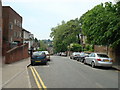
10
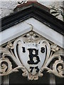
Date stone on the Victorian house in Ethelbert Road, BR1
See Image Photo taken with the kind permission of the house owner.
Image: © Mike Quinn
Taken: 4 Sep 2009
0.04 miles