Old Milestone by High Street, Bromley
Introduction
The photograph on this page of Old Milestone by High Street, Bromley by C Woodward as part of the Geograph project.
The Geograph project started in 2005 with the aim of publishing, organising and preserving representative images for every square kilometre of Great Britain, Ireland and the Isle of Man.

There are currently over 7.5m images from over 14,400 individuals and you can help contribute to the project by visiting https://www.geograph.org.uk
Old Milestone by High Street, Bromley
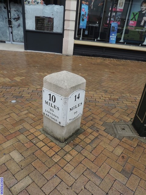
Image: © C Woodward Taken: 12 Feb 2009
Metal plate attached to stone post by the UC road (was A21), in parish of BROMLEY (BROMLEY District), High Street, at Southern end of pedestrian area, 40m from junction with Ethelbert Road, in paved area, on West side of road. Bromley marker, erected by the New Cross turnpike trust in the 20th century. Inscription reads:- : 10 / MILES / TO / LONDON / BRIDGE : : 14 / MILES / TO / SEVENOAKS : Milestone Society National ID: KE_LR10.
Images are licensed for reuse under creativecommons.org/licenses/by-sa/2.0
Image Location
Latitude
51.402944
Longitude
0.015131