
IMAGES TAKEN NEAR TO
Fort Road, NEWHAVEN, BN9 9QE
Introduction
This page details the photographs taken nearby to Fort Road, BN9 9QE by members of the Geograph project.
The Geograph project started in 2005 with the aim of publishing, organising and preserving representative images for every square kilometre of Great Britain, Ireland and the Isle of Man.

There are currently over 7.5m images from over14,400 individuals and you can help contribute to the project by visiting https://www.geograph.org.uk
Image Map
Images are licensed for reuse under creativecommons.org/licenses/by-sa/2.0
Notes
- Clicking on the map will re-center to the selected point.
- The higher the marker number, the further away the image location is from the centre of the postcode.
Image Listing (179 Images Found)
Images are licensed for reuse under creativecommons.org/licenses/by-sa/2.0
Image
Details
Distance
1
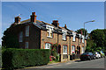
Cottages, Fort Road ,Newhaven
Or possibly houses? Certainly a pleasing design looking out of place in the middle of Newhaven.
Image: © Robin Webster
Taken: 10 Aug 2007
0.02 miles
2

Lorraine Road
A small cul de sac off Fort Road and named after a house of the same name that was demolished in the 1960s to make way for the new fire station. The houses further up face onto Hill Crest Road.
Image: © Simon Carey
Taken: 26 Aug 2012
0.04 miles
3
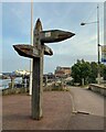
Fingerpost, Riverside, Newhaven
Old timbers are put to new use along this varied walk by the Ouse.
Photo number 7650947.
Image: © Robin Stott
Taken: 14 May 2023
0.05 miles
4
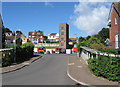
Newhaven Fire Station
Located on Fort Road and opened in the 1970s to replace an older station in Meeching Road. Viewed from the new West Quay road with Fort Road in the foreground in front of the station.
Image: © Simon Carey
Taken: 26 Aug 2012
0.05 miles
5
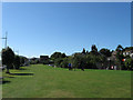
Huggetts Green, West Quay
Built on the track bed of a former shingle line that linked the Lewes to Seaford railway with the beach below Castle Hill next to the Western Breakwater. It derives its name from the local name of a nearby field that is now buried beneath the newly developed West Quay and began to be applied by locals to this small park from which the local council gave its official sanction. The houses on the right front onto Chapel Street.
Image: © Simon Carey
Taken: 26 Aug 2012
0.05 miles
6
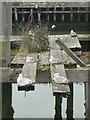
Newhaven: gulls rest on a disused pier at West Quay
The more northern piers at West Quay are in a derelict state, such as this one, number 13, which is utilised now only by seagulls as a resting place.
Image: © Chris Downer
Taken: 20 Jun 2011
0.05 miles
7

Newhaven fire station
Newhaven fire station, Fort Road, Newhaven, East Sussex
Image: © Kevin Hale
Taken: 16 Jun 2007
0.05 miles
8

Hill Side, Newhaven
The road on the left is Meeching Road with South Road at the bottom of the hill. The South Downs can be seen in the distance.
Image: © Kevin Gordon
Taken: 20 Jul 2008
0.06 miles
9
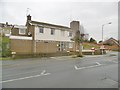
Newhaven Fire Station
On Fort Road: https://www.esfrs.org/about-us/groups-community-fire-stations/west-group-brighton-hove-and-lewes/newhaven-community-fire-station/ (The location seems to differ).
Image: © Mike Faherty
Taken: 24 Nov 2018
0.06 miles
10

Newhaven Fire Station, Fort Road, Newhaven
The drill tower can be seen behind the building.
Image: © Kevin Gordon
Taken: 20 Jul 2008
0.06 miles