IMAGES TAKEN NEAR TO
Valley Dene, NEWHAVEN, BN9 9NF
Introduction
This page details the photographs taken nearby to Valley Dene, BN9 9NF by members of the Geograph project.
The Geograph project started in 2005 with the aim of publishing, organising and preserving representative images for every square kilometre of Great Britain, Ireland and the Isle of Man.

There are currently over 7.5m images from over14,400 individuals and you can help contribute to the project by visiting https://www.geograph.org.uk
Image Map
Images are licensed for reuse under creativecommons.org/licenses/by-sa/2.0
Notes
- Clicking on the map will re-center to the selected point.
- The higher the marker number, the further away the image location is from the centre of the postcode.
Image Listing (29 Images Found)
Images are licensed for reuse under creativecommons.org/licenses/by-sa/2.0
Image
Details
Distance
1
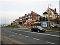
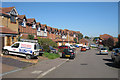
Houses on the Brighton Road
At the western end of Newhaven
Image: © Paul Gillett
Taken: 17 Mar 2010
0.04 miles
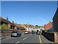
2
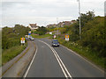
Newhaven
Approaching Newhaven on the A259, Brighton Road.
Image: © David Dixon
Taken: 5 Aug 2012
0.18 miles
3
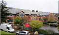
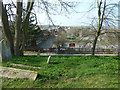
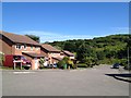
Southdown Junior School, Newhaven
A new brick built junior school with a capacity of over 300.
Image: © Kevin Gordon
Taken: 26 Oct 2008
0.19 miles
5
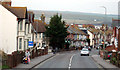
The Fairway
Terraced housing to the West of Newhaven.
Image: © Oast House Archive
Taken: 10 Oct 2010
0.22 miles
6
Newfield Road
Running between Image and Brighton Road, the A259. As the name suggests it was built on the site of New Field, the name the field appeared as in Newhaven's 1841 tithe map.
Image: © Simon Carey
Taken: 31 Aug 2012
0.22 miles
7
St Michael, Newhaven: churchyard (i)
(with the primary school in the background)
Image: © Basher Eyre
Taken: 24 Mar 2012
0.22 miles
8
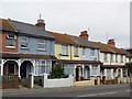
Terraced houses, Brighton Road, Newhaven
Image: © nick macneill
Taken: 4 Aug 2012
0.23 miles
10
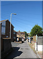
Newfield Lane
Small alley that runs between Image and Image though it was only given the name once Canon Court on the right was built. Otherwise it mainly serves the rear of properties in the above roads along with Brighton Road.
Image: © Simon Carey
Taken: 31 Aug 2012
0.23 miles