IMAGES TAKEN NEAR TO
Brighton Road, NEWHAVEN, BN9 9NA

Introduction

This page details the photographs taken nearby to Brighton Road, BN9 9NA by members of the Geograph project.

The Geograph project started in 2005 with the aim of publishing, organising and preserving representative images for every square kilometre of Great Britain, Ireland and the Isle of Man.

There are currently over 7.5m images from over14,400 individuals and you can help contribute to the project by visiting https://www.geograph.org.uk

Image Map


Images are licensed for reuse under creativecommons.org/licenses/by-sa/2.0
Notes
  • Clicking on the map will re-center to the selected point.
  • The higher the marker number, the further away the image location is from the centre of the postcode.

Image Listing (117 Images Found)

Images are licensed for reuse under creativecommons.org/licenses/by-sa/2.0
  • ...
Image
Details
Distance
1
Newfield Lane
Small alley that runs between Image and Image though it was only given the name once Canon Court on the right was built. Otherwise it mainly serves the rear of properties in the above roads along with Brighton Road.
Image: © Simon Carey Taken: 31 Aug 2012
0.02 miles
2
Terraced houses, Brighton Road, Newhaven
Image: © nick macneill Taken: 4 Aug 2012
0.03 miles
3
Harpers Road
Built in the first decade of the 20th century and named after the field, Harpers Croft, it was built in. The road runs between Lewes Road and Brighton Road and is one way to prevent it being used as a rat run.
Image: © Simon Carey Taken: 31 Aug 2012
0.04 miles
4
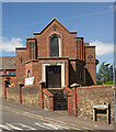
Newhaven Baptist Church
Built in 1938 to a design by F.J. Raynor - https://c20society.org.uk/c20-churches/newhaven-baptist-church.
Image: © Jim Osley Taken: 27 May 2022
0.05 miles
5
Newfield Road
Running between Image and Brighton Road, the A259. As the name suggests it was built on the site of New Field, the name the field appeared as in Newhaven's 1841 tithe map.
Image: © Simon Carey Taken: 31 Aug 2012
0.05 miles
6
Bonfire Night
Members of the Bonfire Society processing through Newhaven on their way to the bonfire. All the Sussex bonfire societies have their own celebrations on successive Saturdays prior to November fifth, and on that day they all combine for a grand procession in Lewes.
Image: © Peter Jeffery Taken: Unknown
0.05 miles
7
Brighton Road (A259), Newhaven
Image: © JThomas Taken: 6 Mar 2012
0.06 miles
8
Flint wall, Newhaven
Image: © nick macneill Taken: 4 Aug 2012
0.07 miles
9
Church Hill
The old road that ran westwards out of Newhaven which was replaced in the 1820s by a new turnpike that is now the A259 to reduce the gradient for coaches. The building on the left is the former lodging house for the Convent of the Sacred Heart whose chapel still survives to its south as an arts centre. The terraced housing to the right dates from the 1900s whilst in the distance is the older Church Hill Cottage.
Image: © Simon Carey Taken: 31 Aug 2012
0.07 miles
10
Site of Newhaven Conservative Club
Located at the junction of South Way and Brighton Road and built in the first decade of the 20th century it burnt down in July 2010. The remains of the building have been removed and the site is currently empty awaiting development. Plenty of rumours have been flying around about planning applications before and after though the fire though fire brigade have insisted it was not started deliberately.
Image: © Simon Carey Taken: 31 Aug 2012
0.07 miles
  • ...