IMAGES TAKEN NEAR TO
Plumpton Green, LEWES, BN7 3DH
Introduction
This page details the photographs taken nearby to BN7 3DH by members of the Geograph project.
The Geograph project started in 2005 with the aim of publishing, organising and preserving representative images for every square kilometre of Great Britain, Ireland and the Isle of Man.

There are currently over 7.5m images from over14,400 individuals and you can help contribute to the project by visiting https://www.geograph.org.uk
Image Map
Images are licensed for reuse under creativecommons.org/licenses/by-sa/2.0
Notes
- Clicking on the map will re-center to the selected point.
- The higher the marker number, the further away the image location is from the centre of the postcode.
Image Listing (28 Images Found)
Images are licensed for reuse under creativecommons.org/licenses/by-sa/2.0
Image
Details
Distance
1
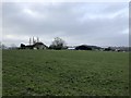
St Helena Farm
Approaching St Helena Farm on the footpath from Wivelsfield Green.
Image: © Chris Thomas-Atkin
Taken: 29 Dec 2019
0.03 miles
2
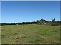
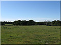
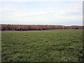
West Field
The name of the field according to the 1844 tithe map and formerly part of Streat Common that was enclosed in the early 17th century. The barn belongs to St Helena Farm which mostly lies out of shot to the right.
Image: © Simon Carey
Taken: 31 Aug 2009
0.03 miles
4
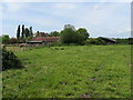
St Helena Farm
Looking north from Middleton Common Lane.
Image: © Simon Carey
Taken: 24 Sep 2005
0.04 miles
5
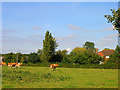
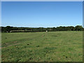
Pit Field
The name of the field according to the 1844 tithe map and formerly part of Streat Common that was enclosed in the early 17th century. The field lies to the front of St Helena Farm which is out of shot to the right.
Image: © Simon Carey
Taken: 31 Aug 2009
0.06 miles
6
Home Mead
The name of the field according to the 1844 tithe map and formerly part of Streat Common that was enclosed in the early 17th century. The line of trees to the right mark the course of the Streat-Plumpton parish border.
Image: © Simon Carey
Taken: 31 Aug 2009
0.09 miles
7
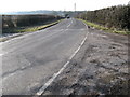
West towards Ditchling
From the entrance to St Helena Farm
Image: © Dave Spicer
Taken: 6 Feb 2010
0.11 miles
8
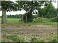
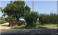
Stile , Waymarker and weightwatchers posts near St Helena Farm
Image: © Dave Spicer
Taken: 4 Jul 2009
0.11 miles
10
Footpath to St Helena Farm
To the right of the telegraph pole the footpath runs alongside the driveway to St Helena Farm.
Image: © Chris Thomas-Atkin
Taken: 29 Aug 2017
0.12 miles