IMAGES TAKEN NEAR TO
South Street, LEWES, BN7 2BP
Introduction
This page details the photographs taken nearby to South Street, BN7 2BP by members of the Geograph project.
The Geograph project started in 2005 with the aim of publishing, organising and preserving representative images for every square kilometre of Great Britain, Ireland and the Isle of Man.

There are currently over 7.5m images from over14,400 individuals and you can help contribute to the project by visiting https://www.geograph.org.uk
Image Map
Images are licensed for reuse under creativecommons.org/licenses/by-sa/2.0
Notes
- Clicking on the map will re-center to the selected point.
- The higher the marker number, the further away the image location is from the centre of the postcode.
Image Listing (685 Images Found)
Images are licensed for reuse under creativecommons.org/licenses/by-sa/2.0
Image
Details
Distance
1
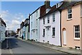
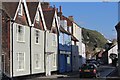
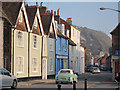
South Street Fish Bar
Until 1980 South Street was the main A26 out of Lewes. Now replaced by the Cuilfail Tunnel the road is a quiet back street.
Image: © Simon Carey
Taken: 9 Dec 2006
0.00 miles
6
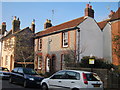
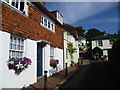
1, South Street
Grade II listed. http://www.britishlistedbuildings.co.uk/en-293423-1-south-street-lewes-east-sussex
Image: © N Chadwick
Taken: 12 Jul 2015
0.02 miles
7
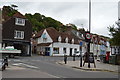
Looking up Chapel Hill
Where the main west-east shopping street in Lewes ends beyond Cliffe High Street, crossing over Malling Street/South Street leads to Chapel Hill. It is quite a steep climb with no parked cars. This is looking up the hill from near the bottom.
Image: © Marathon
Taken: 6 Sep 2012
0.03 miles
8
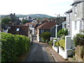
Looking down Chapel Hill
Where the main west-east shopping street in Lewes ends beyond Cliffe High Street, crossing over Malling Street/South Street leads to Chapel Hill. It is quite a steep climb with no parked cars. This is looking down the hill from near the bottom. The tower belongs to St Thomas a Becket Church in Cliffe High Street and the hill in the distance is Landport Bottom
Image: © Marathon
Taken: 6 Sep 2012
0.03 miles
9
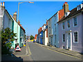
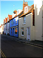
South Street
The former A27 now a sleepy backwater. Looking up towards the junction with Cliffe High Street.
Image: © Simon Carey
Taken: 20 Sep 2008
0.03 miles
10
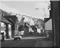
South Street
A dead end street leading away from the centre. This road would once have been a main road into the town but has been bypassed by through the Cuilfail Tunnel behind the buildings to the left.
A green Nissan Figaro passes.
Image: © Oast House Archive
Taken: 4 Mar 2011
0.03 miles