IMAGES TAKEN NEAR TO
Dale Road, LEWES, BN7 1LH

Introduction

This page details the photographs taken nearby to Dale Road, BN7 1LH by members of the Geograph project.

The Geograph project started in 2005 with the aim of publishing, organising and preserving representative images for every square kilometre of Great Britain, Ireland and the Isle of Man.

There are currently over 7.5m images from over14,400 individuals and you can help contribute to the project by visiting https://www.geograph.org.uk

Image Map


Images are licensed for reuse under creativecommons.org/licenses/by-sa/2.0
Notes
  • Clicking on the map will re-center to the selected point.
  • The higher the marker number, the further away the image location is from the centre of the postcode.

Image Listing (70 Images Found)

Images are licensed for reuse under creativecommons.org/licenses/by-sa/2.0
  • ...
Image
Details
Distance
1
Winterbourne Lane
Taken from the junction with Winterbourne Hollow with the Winterbourne Stream on the left living up to its name. The bridge enables access to Winterbourne Close and Hillyfields.
Image: © Simon Carey Taken: 8 Feb 2009
0.07 miles
2
Winterbourne Cottage
Viewed from the junction of Winterbourne Lane with Winterbourne Hollow. The cottage is actually the former farmhouse of Winterbourne Farm which has been swallowed up by the growth of Lewes, some of the former barns have been converted into dwellings which now form Winterbourne Mews.
Image: © Simon Carey Taken: 8 Feb 2009
0.08 miles
3
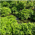
Winterbourne Stream
At first glance, this looks like an aerial view of a river running through a rain forest. I think the plants here are mostly Hemlock Water Dropwort (Oenanthe crocata) - but I could be wrong.
Image: © Ian Hawfinch Taken: 8 Apr 2023
0.13 miles
4
Lewes Cemetery
Lewes Prison can be seen in the top left of the picture with the houses in St Annes Crescent on the horizon. The cemetery chapel is on the right. Photograph taken from Jubilee Gardens, Juggs Lane.
Image: © Kevin Gordon Taken: 31 Jan 2009
0.13 miles
5
Reservoir alongside Jugg's Road
Image: © Dave Spicer Taken: 14 May 2010
0.13 miles
6
A277
Image: © N Chadwick Taken: 7 Apr 2016
0.14 miles
7
Entrance to Lewes Prison
Lewes Prison is a local prison, holding convicted and remand adult males mainly from East and West Sussex courts, it was built in 1853 http://en.wikipedia.org/wiki/Lewes_(HM_Prison)
Image: © Paul Gillett Taken: 2 Jan 2010
0.14 miles
8
Greenwich Meridian in Lewes Cemetery
This picture was taken standing on the Greenwich meridian looking South. The left half of the image is in the Eastern Hemisphere and the right is in the Western. The meridian passes straight through the middle, see this http://www.riddlerworld.co.uk/meridian/PG0977.htm for an alternate image with the meridian superimposed as a yellow line. The Meridian goes through the middle of Lewes Cemetery.
Image: © steve ridley Taken: 8 Mar 2011
0.15 miles
9
Greenwich Meridian in Lewes Cemetery
This picture was taken standing on the Greenwich meridian looking South. The left half of the image is in the Eastern Hemisphere and the right is in the Western. The meridian passes straight through the middle, see this http://www.riddlerworld.co.uk/meridian/PG0971.htm for an alternate image with the meridian superimposed as a yellow line. The meridian cuts through the south end of Lewes Cemetery.
Image: © steve ridley Taken: 8 Mar 2011
0.15 miles
10
Short rail tunnel passing under Jugg's Road bridge
Image: © Dave Spicer Taken: 14 May 2010
0.16 miles
  • ...