IMAGES TAKEN NEAR TO
Cuckfield Road, HASSOCKS, BN6 9LG

Introduction

This page details the photographs taken nearby to Cuckfield Road, BN6 9LG by members of the Geograph project.

The Geograph project started in 2005 with the aim of publishing, organising and preserving representative images for every square kilometre of Great Britain, Ireland and the Isle of Man.

There are currently over 7.5m images from over14,400 individuals and you can help contribute to the project by visiting https://www.geograph.org.uk

Image Map


Images are licensed for reuse under creativecommons.org/licenses/by-sa/2.0
Notes
  • Clicking on the map will re-center to the selected point.
  • The higher the marker number, the further away the image location is from the centre of the postcode.

Image Listing (26 Images Found)

Images are licensed for reuse under creativecommons.org/licenses/by-sa/2.0
  • ...
Image
Details
Distance
1
Jewson Ltd, Cuckfield Road, Goddards Green
Located to the south of Image both of which were once a field called Five and a Half. The drive lies to the immediate north of Image
Image: © Simon Carey Taken: 25 Jul 2014
0.02 miles
2
GE Richardson & Son, Cuckfield Road, Goddards Green
A scrap metal merchant located at the northern end of the small hamlet. It lies between Image to the north and Image to the south.
Image: © Simon Carey Taken: 25 Jul 2014
0.03 miles
3
Hurstfield Cottages, Cuckfield Road, Goddards Green
Located to the immediate north of Image with the drive to Image beyond. They seem to date from 1930s.
Image: © Simon Carey Taken: 25 Jul 2014
0.06 miles
4
Goddard's Green
Small hamlet situated between Burgess Hill and the A23(T) consisting of the Sportsman Inn, a few cottages, a sawmill and a timber depot. Until the building of the A2300 these country lanes were full of traffic taking shortcuts from the A23 to Burgess Hill, only the north-south Cuckfield-Hurstpierpont road is in operation the east-west lanes are now dead ends and the one to the left is beginning to become overgrown. This view looks north.
Image: © Simon Carey Taken: 5 Nov 2005
0.06 miles
5
Gothards Green Field
The name of the field according to Hurstpierpoint's 1842 tithe map that runs along the northern side of Gatehouse Lane with Image visible in the distance.
Image: © Simon Carey Taken: 25 Jul 2014
0.07 miles
6
Gatehouse Lane
Looking towards Image with the junction to High Hatch Lane to the left. Up to 1997 this was the main route used by those wishing to get to the A23 from Burgess Hill until replaced by the new A2300.
Image: © Simon Carey Taken: 25 Jul 2014
0.07 miles
7
The Sportsman
A curious layout for a pub. It appears to be a house with attached bungalow.
Image: © David Lally Taken: 9 Jun 2017
0.07 miles
8
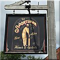
The sign of The Sportsman
Nice, but not as interesting as a former one: Image
Image: © David Lally Taken: 9 Jun 2017
0.07 miles
9
Cuckfield Road
Heading south from the roundabout on the A2300 towards Goddards Green. The road was built as a turnpike in the early 19th century connecting two other London-Brighton roads of the era.
Image: © Simon Carey Taken: 25 Jul 2014
0.07 miles
10
The Sportsman Inn, Gatehouse Lane, Goddards Green
The building dates from around 1800 and was originally a beer house and predates Cuckfield Road running past it which was created as a turnpike in the early 19th century. Marked as Goodards Green House on Hurstpierpoint's 1842 tithe map it was probably turned into an inn around 1850.
Image: © Simon Carey Taken: 25 Jul 2014
0.07 miles
  • ...