The Sportsman Inn, Gatehouse Lane, Goddards Green
Introduction
The photograph on this page of The Sportsman Inn, Gatehouse Lane, Goddards Green by Simon Carey as part of the Geograph project.
The Geograph project started in 2005 with the aim of publishing, organising and preserving representative images for every square kilometre of Great Britain, Ireland and the Isle of Man.

There are currently over 7.5m images from over 14,400 individuals and you can help contribute to the project by visiting https://www.geograph.org.uk
The Sportsman Inn, Gatehouse Lane, Goddards Green
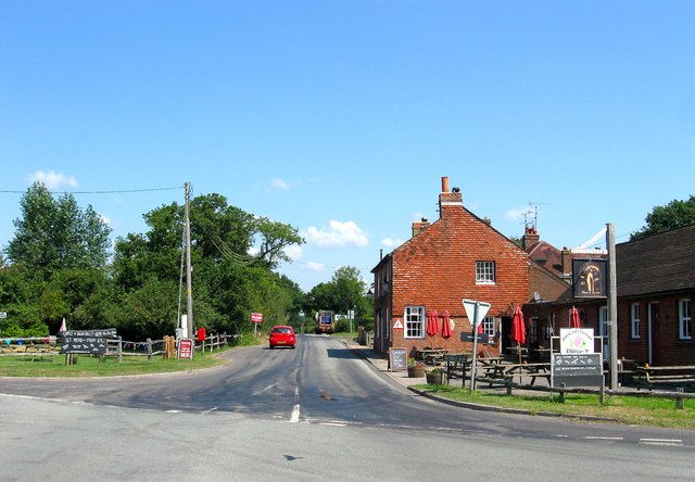
Image: © Simon Carey Taken: 25 Jul 2014
The building dates from around 1800 and was originally a beer house and predates Cuckfield Road running past it which was created as a turnpike in the early 19th century. Marked as Goodards Green House on Hurstpierpoint's 1842 tithe map it was probably turned into an inn around 1850.
Images are licensed for reuse under creativecommons.org/licenses/by-sa/2.0
Image Location
Latitude
50.966092
Longitude
-0.171704