Goddard's Green
Introduction
The photograph on this page of Goddard's Green by Simon Carey as part of the Geograph project.
The Geograph project started in 2005 with the aim of publishing, organising and preserving representative images for every square kilometre of Great Britain, Ireland and the Isle of Man.

There are currently over 7.5m images from over 14,400 individuals and you can help contribute to the project by visiting https://www.geograph.org.uk
Goddard's Green
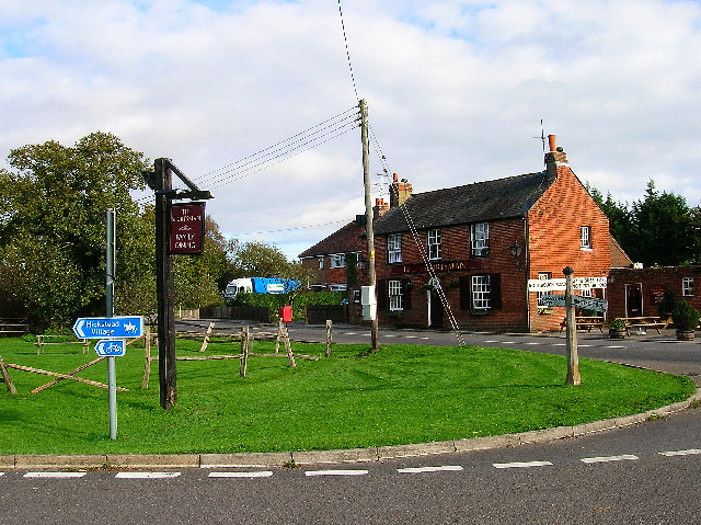
Image: © Simon Carey Taken: 5 Nov 2005
Small hamlet situated between Burgess Hill and the A23(T) consisting of the Sportsman Inn, a few cottages, a sawmill and a timber depot. Until the building of the A2300 these country lanes were full of traffic taking shortcuts from the A23 to Burgess Hill, only the north-south Cuckfield-Hurstpierpont road is in operation the east-west lanes are now dead ends and the one to the left is beginning to become overgrown. This view looks north.
Images are licensed for reuse under creativecommons.org/licenses/by-sa/2.0
Image Location


Leaflet Map data © OpenStreetMap
Latitude
50.965998
Longitude
-0.171422