
IMAGES TAKEN NEAR TO
Barn Close, HASSOCKS, BN6 9DG
Introduction
This page details the photographs taken nearby to Barn Close, BN6 9DG by members of the Geograph project.
The Geograph project started in 2005 with the aim of publishing, organising and preserving representative images for every square kilometre of Great Britain, Ireland and the Isle of Man.

There are currently over 7.5m images from over14,400 individuals and you can help contribute to the project by visiting https://www.geograph.org.uk
Image Map
Images are licensed for reuse under creativecommons.org/licenses/by-sa/2.0
Notes
- Clicking on the map will re-center to the selected point.
- The higher the marker number, the further away the image location is from the centre of the postcode.
Image Listing (86 Images Found)
Images are licensed for reuse under creativecommons.org/licenses/by-sa/2.0
Image
Details
Distance
1
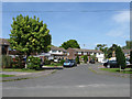
Barn Close
Cul-de-sac off The Street built in the postwar period.
Image: © Simon Carey
Taken: 10 May 2009
0.01 miles
2
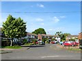
Barn Close, Albourne
A cul de sac off The Street built in the 1970s. This area of Albourne is known as Albourne Green.
Image: © Simon Carey
Taken: 16 May 2014
0.01 miles
3
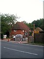
Goldsmiths, Henfield Road, Albourne
Dating from the 17th century and one of the few surviving buildings that were built around what was Albourne Green.
Image: © Simon Carey
Taken: 16 May 2014
0.03 miles
4
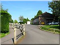
Albourne Village Hall
Built in 1977 to replace an older hall that had been in use since the 1920s. The path on the left leads to Image
Image: © Simon Carey
Taken: 16 May 2014
0.03 miles
5
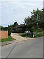
Albourne Village Hall
Viewed from The Street. Built in the late 1970s to replace an older hall in Henfield Road.
Image: © Simon Carey
Taken: 10 May 2009
0.03 miles
6
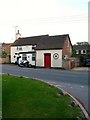
Postbox Cottage, Henfield Road, Albourne
The former village post office which closed in 1977. Behind it are some of the houses that can be found in Image
Image: © Simon Carey
Taken: 16 May 2014
0.04 miles
7
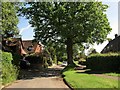
The Street, Albourne
The houses on the left are Yew Trees and Firbank respectively whilst those to the right belong to the Hunters Mead estate.
Image: © Simon Carey
Taken: 25 May 2014
0.05 miles
8
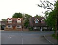
Ash Cottage/Hackhurst, Henfield Road, Albourne
Viewed from the entrance to Image Ash Cottage is on the left whilst that on the right is Hackhurst. To the immediate east of the latter is Image
Image: © Simon Carey
Taken: 16 May 2014
0.06 miles
9
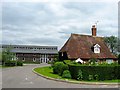
Inholmes Cottage, Henfield Road, Albourne
The cottage dates from the 17th century and would have been built adjacent to the old Albourne Green. Now located at the junction of the B2116 and service road to Image
Image: © Simon Carey
Taken: 31 May 2014
0.06 miles
10
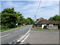
Henfield Road
The B2116 that runs through the northern end of the village. Originally the Albourne was split into three distinct parts, a small cluster of houses around the church to the south, Albourne Street that lay around the junction of Church Lane and The Street, and this part, Albourne Green, which lay around the road to Henfield. The coming of the London-Brighton turnpike then main road meant the latter two eventually coalesced to formed the current village of Albourne. The brick wall on the right is the former village pound constructed in the 17th century and restored in the mid 1980s. Taken from the junction with The Street.
Image: © Simon Carey
Taken: 10 May 2009
0.06 miles