Henfield Road
Introduction
The photograph on this page of Henfield Road by Simon Carey as part of the Geograph project.
The Geograph project started in 2005 with the aim of publishing, organising and preserving representative images for every square kilometre of Great Britain, Ireland and the Isle of Man.

There are currently over 7.5m images from over 14,400 individuals and you can help contribute to the project by visiting https://www.geograph.org.uk
Henfield Road
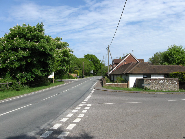
Image: © Simon Carey Taken: 10 May 2009
The B2116 that runs through the northern end of the village. Originally the Albourne was split into three distinct parts, a small cluster of houses around the church to the south, Albourne Street that lay around the junction of Church Lane and The Street, and this part, Albourne Green, which lay around the road to Henfield. The coming of the London-Brighton turnpike then main road meant the latter two eventually coalesced to formed the current village of Albourne. The brick wall on the right is the former village pound constructed in the 17th century and restored in the mid 1980s. Taken from the junction with The Street.
Images are licensed for reuse under creativecommons.org/licenses/by-sa/2.0
Image Location
Latitude
50.937258
Longitude
-0.202866