
IMAGES TAKEN NEAR TO
London Road, HASSOCKS, BN6 9BW
Introduction
This page details the photographs taken nearby to London Road, BN6 9BW by members of the Geograph project.
The Geograph project started in 2005 with the aim of publishing, organising and preserving representative images for every square kilometre of Great Britain, Ireland and the Isle of Man.

There are currently over 7.5m images from over14,400 individuals and you can help contribute to the project by visiting https://www.geograph.org.uk
Image Map
Images are licensed for reuse under creativecommons.org/licenses/by-sa/2.0
Notes
- Clicking on the map will re-center to the selected point.
- The higher the marker number, the further away the image location is from the centre of the postcode.
Image Listing (72 Images Found)
Images are licensed for reuse under creativecommons.org/licenses/by-sa/2.0
Image
Details
Distance
1
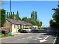
Butts Cottages, London Road, Albourne
A row of single storey 19th century agricultural cottages on the B2118 named after the field that once stood to the rear and now occupied by a cul-de-sac called Leyfield. the traffic lights in the distance marks the junction with the B2116.
Image: © Simon Carey
Taken: 3 May 2014
0.00 miles
2
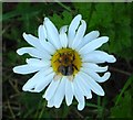
Pollinating, London Road, Albourne
A bee collects pollen from a daisy on the eastern verge of the B2118.
Image: © Simon Carey
Taken: 31 May 2014
0.03 miles
3
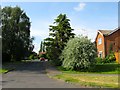
Leyfield, Albourne
A small cup de sac added around the late 1960s/early 1970s that runs north from Church Lane. The estate was built on a former field known as The Butts according to Albourne's 1839 tithe map, the name is commemorated by Image which lie to the east.
Image: © Simon Carey
Taken: 16 May 2014
0.04 miles
5
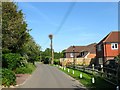
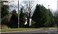
Church Lane, Albourne
Looking towards the junction with London Road. The houses on the immediate right is a fir lay recent addition whilst the building further on containing two properties was constructed during the 1970s both on the former site of Hazeldens Nurseries.
Image: © Simon Carey
Taken: 16 May 2014
0.06 miles
6
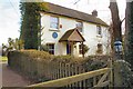
Woodbine Cottage
The blue plaque on the wall reads;- "Father of the British Cycle Industry James Starley 1830-1881 lived at the original Woodbine Cottage until 1846".
Image: © Peter Jeffery
Taken: 1 Feb 2009
0.08 miles
7
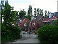
New development, London Road, Albourne
An infill development being built on the old car park for the former Kings Head Inn which is now Image The car park itself was once a small field called Home Close according to Albourne's 1839 tithe map.
Image: © Simon Carey
Taken: 16 May 2014
0.08 miles
8
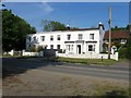
Elm Studio/Elm House/Mole Manor, London Road, Albourne
Actually located on the Hurstpierpoint side of the road but part of the village of Albourne. Elm House located in the centre was originally known as Elm Villa and was built in the early 19th century when on what had recently become the main London-Brighton road. To its left is Elm Studio, a modern edition built in the same style, whilst on the right is Mole Manor which dates from the 17th century. Another building is attached to the south of this, out of shot, called Tipnoaks which dates from the same period as Elm House and is built in the same style.
Image: © Simon Carey
Taken: 16 May 2014
0.08 miles
9
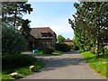
Hamiltons/Choppers, Church Lane, Albourne
A fairly recent infill development off Church Lane. Judging by OS maps of 1956 through to 1977, a building called Choppers was located here within a small 'L' shaped plot of land. However, the layout nor position of the original Choppers matches the current one which is viewed side on down the drive, and thus looks likely to be a recent development. Hamiltons is the house on the left whilst another, not in shot, called Pinewoods, completes the trio.
Image: © Simon Carey
Taken: 16 May 2014
0.09 miles
10
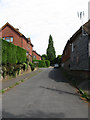
The Twitten
Kind of emphasises the boundary between the older part of Albourne, once known as Albourne Street, and the newer 20th century part of the village. Twitten itself is an old Sussex name for a narrow alley which the route becomes beyond the car in the distance forming a path to London Road.
Image: © Simon Carey
Taken: 10 May 2009
0.09 miles