IMAGES TAKEN NEAR TO
Cecil Pashley Way, SHOREHAM-BY-SEA, BN43 5FF

Introduction

This page details the photographs taken nearby to Cecil Pashley Way, BN43 5FF by members of the Geograph project.

The Geograph project started in 2005 with the aim of publishing, organising and preserving representative images for every square kilometre of Great Britain, Ireland and the Isle of Man.

There are currently over 7.5m images from over14,400 individuals and you can help contribute to the project by visiting https://www.geograph.org.uk

Image Map


Images are licensed for reuse under creativecommons.org/licenses/by-sa/2.0
Notes
  • Clicking on the map will re-center to the selected point.
  • The higher the marker number, the further away the image location is from the centre of the postcode.

Image Listing (55 Images Found)

Images are licensed for reuse under creativecommons.org/licenses/by-sa/2.0
  • ...
Image
Details
Distance
1
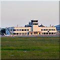
Shoreham Airport
Image: © Peter Jeffery Taken: Unknown
0.01 miles
2
Propeller memorial outside Shoreham Airport
The propeller is from a Martin B-26 Marauder that came down in the English Channel in June 1944. "This memorial is dedicated to all the British, Commonwealth and Allied servicemen and women who gave their lives during the first and second world wars. WE WILL REMEMBER THEM"
Image: © Jeff Tomlinson Taken: 25 Sep 2005
0.03 miles
3
Shoreham Airport
Viewed from the footpath on the western side of the River Adur. The land was once an inlet which stretched across to the outskirts of modern day Lancing until silting up in the 14th and 15th century. After that the area was inned and farmed until 1911 when a new aerodrome was opened on the site. The terminal building was added in 1935 and is still in use today.
Image: © Simon Carey Taken: 18 Oct 2008
0.04 miles
4
Post-war aviation: Miles Marathon at Shoreham, 1960
On re-discovering this box-Brownie photograph - taken when I was a schoolboy - I couldn’t help wondering whether this aircraft ever flew again. The plane is a Handley-Page [aka Miles] Marathon, surplus to RAF requirements. In May 1960 it was still in RAF training colours, though the civil registration G-AMER had been painted on the rear fuselage. By some miracle the spotter’s notebook I kept at the time has survived, and it tells me that there were four Marathons at Shoreham that day, all equally woe-begone. I believe I’ve located the image with reasonable accuracy - the tower of the terminal building https://www.geograph.org.uk/photo/573952 is visible above the plane’s nose, and the direction of view is roughly eastward. Searching the Air Britain photo collection https://abpic.co.uk/pictures/search?type=marathon&airport=shoreham&date_taken=&information=&tag_fields=%5B%22type%22%2C%22airport%22%5D I found that all four Marathons at Shoreham were doomed, broken up within a few years. Pre-war light aircraft - such as the Tiger Moth - survived for club-flying, but it seems there was no market for the Marathon [dating from circa 1946]. As a period touch, notice the flash Mercedes in the right foreground - with US-style sun-visor.
Image: © Stefan Czapski Taken: 21 May 1960
0.04 miles
5
Shoreham Airport
Image: © N Chadwick Taken: 8 May 2011
0.04 miles
6
Hangar, Shoreham Airport
Grade II listed. http://www.britishlistedbuildings.co.uk/en-503030-municipal-hangar-at-shoreham-airport-sho
Image: © N Chadwick Taken: 8 May 2011
0.05 miles
7
Shoreham Airport
The oldest airport in the UK having been in operation since 1910. Viewed at sunset.
Image: © Simon Carey Taken: 25 May 2020
0.05 miles
8
Terminal Building, Shoreham Airport
Image: © Simon Palmer Taken: 10 Mar 2007
0.05 miles
9
Ceiling, Shoreham Airport terminal
Image: © nick macneill Taken: 20 Jan 2012
0.06 miles
10
Terminal Building, Shoreham Airport
Built in 1936 and still in use today. A cafe/restaurant is located in western part of the downstairs building along with outdoor seating for those with a penchant for plane spotting.
Image: © Simon Carey Taken: 25 May 2020
0.06 miles
  • ...