IMAGES TAKEN NEAR TO
Southwick Street, BRIGHTON, BN42 4TJ
Introduction
This page details the photographs taken nearby to Southwick Street, BN42 4TJ by members of the Geograph project.
The Geograph project started in 2005 with the aim of publishing, organising and preserving representative images for every square kilometre of Great Britain, Ireland and the Isle of Man.

There are currently over 7.5m images from over14,400 individuals and you can help contribute to the project by visiting https://www.geograph.org.uk
Image Map
Images are licensed for reuse under creativecommons.org/licenses/by-sa/2.0
Notes
- Clicking on the map will re-center to the selected point.
- The higher the marker number, the further away the image location is from the centre of the postcode.
Image Listing (22 Images Found)
Images are licensed for reuse under creativecommons.org/licenses/by-sa/2.0
Image
Details
Distance
1
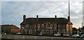
Windmill Inn
On the Old Shoreham Road at Southwick
The Pub was demolished Sept 2010 and flats are being built on the site http://www.theargus.co.uk/news/8344649.Brighton_pub_is_set_to_be_demolished/
Image: © Paul Gillett
Taken: 24 Jan 2010
0.08 miles
2
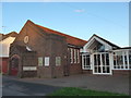
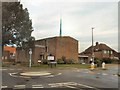
Southwick Methodist Church: December 2014 (a)
Image: © Basher Eyre
Taken: 19 Dec 2014
0.11 miles
3
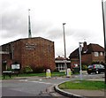
Roman Way
Residential street that lies between Southview Road, the B2167, and Roman Road. Named after a Roman villa that once existed nearby between the 1st and 4th centuries.
Image: © Simon Carey
Taken: 2 Dec 2010
0.12 miles
4
Southwick Methodist Church, West Sussex
Image: © nick macneill
Taken: 20 Jan 2012
0.13 miles
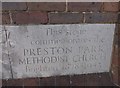
5
Southwick Methodist Church: commemoration stone (i)
Image: © Basher Eyre
Taken: 19 Dec 2014
0.13 miles
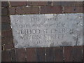
6
Southwick Methodist Church: commemoration stone (ii)
Image: © Basher Eyre
Taken: 19 Dec 2014
0.13 miles
7
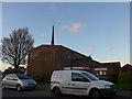
Southwick Methodist Church: December 2014 (c)
Image: © Basher Eyre
Taken: 19 Dec 2014
0.13 miles
8
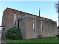
Southwick Methodist Church: December 2014 (b)
Image: © Basher Eyre
Taken: 19 Dec 2014
0.14 miles
10
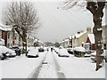
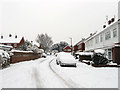
Southview Road
Laid out in the 1890s and developed in the first decade of the 20th century. The B2167 links the northern end of The Green with Old Shoreham Road, the A270. After 8-10 inches of snow fell overnight there is little traffic except the use of feet.
Image: © Simon Carey
Taken: 2 Dec 2010
0.16 miles