IMAGES TAKEN NEAR TO
Brambledean Road, BRIGHTON, BN41 1LP
Introduction
This page details the photographs taken nearby to Brambledean Road, BN41 1LP by members of the Geograph project.
The Geograph project started in 2005 with the aim of publishing, organising and preserving representative images for every square kilometre of Great Britain, Ireland and the Isle of Man.

There are currently over 7.5m images from over14,400 individuals and you can help contribute to the project by visiting https://www.geograph.org.uk
Image Map
Images are licensed for reuse under creativecommons.org/licenses/by-sa/2.0
Notes
- Clicking on the map will re-center to the selected point.
- The higher the marker number, the further away the image location is from the centre of the postcode.
Image Listing (98 Images Found)
Images are licensed for reuse under creativecommons.org/licenses/by-sa/2.0
Image
Details
Distance
1
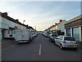
St Richards Road, Fishersgate
Completed just before the First World War and linking Fishersgate Terrace, the A259, to Eastbrook Road.
Image: © Simon Carey
Taken: 17 May 2020
0.04 miles
2
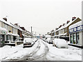
St Richard's Road, Fishersgate
Side street connecting Fishersgate Terrace, the A259, with Eastbrook Road. It was developed on the site of an old brick field in the 1920s.
Image: © Simon Carey
Taken: 2 Dec 2010
0.04 miles
3
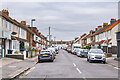
St Richards Road
c.1910s/20s housing, first shown on the 1932 25 inch map.
Image: © Ian Capper
Taken: 21 Jan 2022
0.06 miles
4
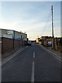
Mill Road, Fishersgate
The road dates from the 1850s and heads north before meeting a dead end. At the far end was a windmill which was used to manufacture cement and is marked as such on the early 1870s OS map. However, it was demolished in 1873. Much of the road is now an industrial estate.
Image: © Simon Carey
Taken: 17 May 2020
0.08 miles
5
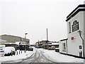
Mill Road, Fishersgate
The road dates from the 1850s and heads north before meeting a dead end. At the far end was a windmill which was used to manufacture cement and is marked as such on the early 1870s OS map. However, it was demolished in 1873. Much of the road is an industrial estate including the builders Adenstar whose offices are now located in a former pub, the Sussex Arms Inn, on the right.
Image: © Simon Carey
Taken: 2 Dec 2010
0.08 miles
6

Ottima, Wellington Road
Joinery and furniture business.
Image: © Oast House Archive
Taken: 1 Sep 2011
0.10 miles
7
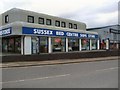
Sussex Bed Centre, Fishersgate
On the Brighton Road. website: http://www.sussexbedcentre.co.uk/stores/portslade.php
Image: © Paul Gillett
Taken: 26 Feb 2011
0.10 miles
8
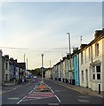
Church Road, Portslade-By-Sea
Built up in the 1860s and currently the A293 linking the A259 to the A270, having recently been upgraded from the B2193. The road is the main access route for lorries wishing to use Shoreham Harbour.
Image: © Simon Carey
Taken: 17 May 2020
0.10 miles
9
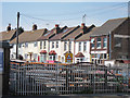
St Peter's Road
Looking across a metal yard by Church Road.
Image: © Oast House Archive
Taken: 1 Sep 2011
0.11 miles