1
Raphael Road
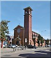
Residential street linking Portland Road to Lawrence Road that was developed between 1906-22. The pub on the right is the Three Graces which was formerly The Vault.
Image: © Simon Carey
Taken: 2 Dec 2010
0.03 miles
2
Raphael Road, Aldrington, Hove
A residential road that runs between Lawrence Road and Portland. The road had been laid out in the first decade of the 20th century with only a few houses at the southern end completed by the 1911 OS map with the rest added by the First World War. Named after the 15th century Italian painter, one of a number of roads in the vicinity named after an artist.
Image: © Simon Carey
Taken: 11 Dec 2016
0.03 miles
3
Titian Road, Aldrington, Hove
A residential road linking Lawrence Road to Portland Road. Developed from 1911 and completed by the 1920s. It is one of a number of roads in the vicinity named after artists, in this instance the 16th century Italian painter.
Image: © Simon Carey
Taken: 11 Dec 2016
0.04 miles
4
Modena Road, Aldrington, Hove
A residential road that links Lawrence Road to Portland Road which was largely completed by 1914. St Peter's Roman Catholic church is at the far end of the street.
Image: © Simon Carey
Taken: 11 Dec 2016
0.06 miles
5
Lawrence Road, Aldrington, Hove
A residential road that runs between Rutland Gardens and Hogarth Road. The eastern end in view had been developed as far as Raphael Road by the 1911 OS map with the rest completed by the 1920s. Named after portriatist Sir Thomas Lawrence and one of a number in the vicinity named after painters.
Image: © Simon Carey
Taken: 11 Dec 2016
0.08 miles
6
Portland Road, Aldrington
Taken from the top of the No2 bus from Shoreham-by-Sea to Brighton. The RC church of st John provides a unique landmark.
Image: © Bob Embleton
Taken: 19 Apr 2006
0.08 miles
7
Lawrence Road
Image: © Oast House Archive
Taken: 16 Oct 2010
0.08 miles
8
The Stoneham, Portland Road, Aldrington, Hove
Located on the corner of Scott Road which the building predates. Opened in 1896 as the Portland Hotel which was later shortened to the Portland until about five years ago when it was changed to its current name. The building was rebuilt in 1928, see http://regencysociety-jamesgray.com/volume16/source/jg_16_022.html for a view taken in 1911.
Image: © Simon Carey
Taken: 14 Jan 2017
0.09 miles
9
Hove, Catholic church
St. Peter's RC Church, on Portland Road. Listed by Historic England (Grade II): http://www.imagesofengland.org.uk/Details/Default.aspx?id=365617&mode=adv http://www.stpeters-hove.org.uk/
Image: © Mike Faherty
Taken: 15 Sep 2018
0.09 miles
10
Reynolds Road, Aldrington, Hove
A residential road that links Lawrence Road to Portland Road that was developed in the 1920s. One of a number in the vicinity named after artists, in the case Sir Joshua Reynolds.
Image: © Simon Carey
Taken: 11 Dec 2016
0.09 miles


